
 Frances Windolf
A long-time Coolum resident with a passion for local history
C.A.T.S. in May
EVERY fortnight I search carefully through relevant snippets of Coolum history for this column, and I was recently delighted to find a newspaper clipping with a dateline headlined “MAY 22, 1959”- precisely 65 years ago from the day that a newspaper article, headlined COOLUM THEATRE SOCIETY REVIEW, was printed in the Nambour Chronicle.
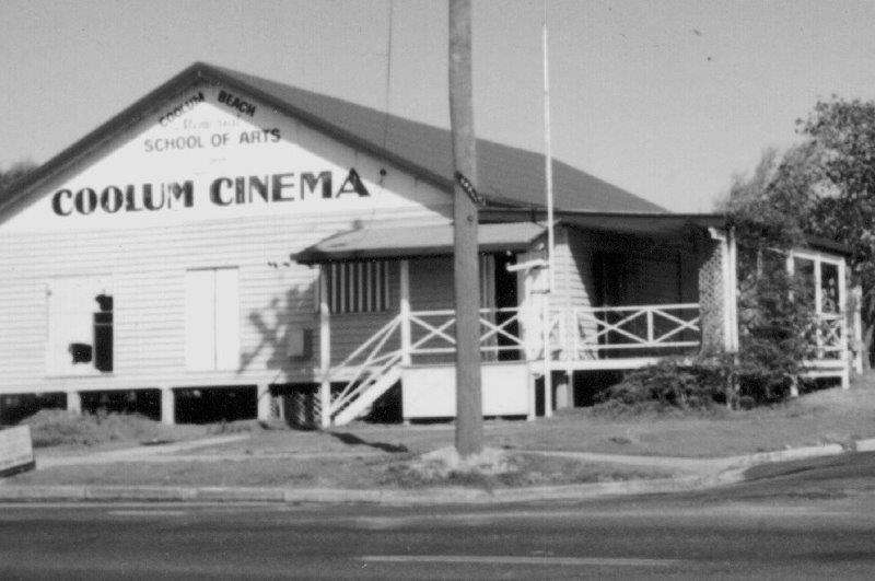
The article introduced the revue “C.A.T.S. in May”, presented by the Coolum Amateur Theatre Society [CATS!] in the Coolum Beach Memorial School of Arts, built in 1950, and fondly remembered in later times by many Coolum residents as the Coolum Cinema. Electricity had come to the hall in 1956, so evenings such as the “C.A.T.S in May” were a delight in that pre-television era!
The revue began with several ‘popular numbers’ by Bill Kennedy and Dick Kemp, and several ‘humorous songs’ by Mrs. Holt and Mr Luke, followed by Joan Lambert, “a well-known Coolum singer”, whose family still has connections to modern-day Coolum.
These were followed by some violin solos and then Jimmy Kerr and his Hawaiian Band, who stopped the show with several popular numbers. Then it was time for the dancers – Pam McEwen with well-known tap dance numbers, and Terry Deane, a “Borovansky Ballet scholarship winner” who still lives in this area, followed by Beryl Doyle [whose family members still reside in Coolum] presenting a hilarious schoolgirl characterisation and eccentric dancing which won several encores!
One of the main features of the show was a skit on old time melodramas, called “Cast up by the Sea”, which had five scenes and thirteen characters, including Marie Doyle, Mrs. Boneham, Ivy Sakrewski, George Dann – a well-known professional actor and playwright who lived in Coolum – and Mrs. Labatt, the narrator and compere of the review. Other well-known Coolum residents from that time worked behind the scenes – Mrs. Garrard as the pianist, and Keith Peterie on the drums, electrician Ron Filer on the lights, Des Beck in charge of front-of-house staff, and Nancy Newitt as stage-manager and wardrobe mistress.
The evening was in aid of the Q.A.T.B. – the ambulance brigade – even though the Ambulance Station in William Street was not opened until 1978, for many years the Nambour Ambulance Brigade provided an officer at Coolum in holiday times. The concert raised twenty-four pounds [forty-eight dollars] and a “generous donation” was also given by Coolum resident Martin Oosthenzen. What a change from today’s prices!
I find it interesting, in an era when most Coolum area residents are new to this part of the Sunshine Coast, that many families from that time still have local family members or ‘connections’ with residents from sixty-five years ago … I would love to hear of other Coolum memories like this. If you have any interesting connections please email your stories to editor@coolumadvertiser.com.au
Reminiscing on Mother’s Day
MOTHER’S Day has always been important to me and my five siblings, but I also remember my mother-in-law, Florie Windolf.
Florie was born on Mount French, and married at Kalbar, but during World War Two she moved from Kalbar with her daughter Caryll, to be near her parents who had a farm on Buderim Mountain. Her husband Alex Windolf served as a Military Policeman.
Florie and Alex’s son, John was born in 1942.
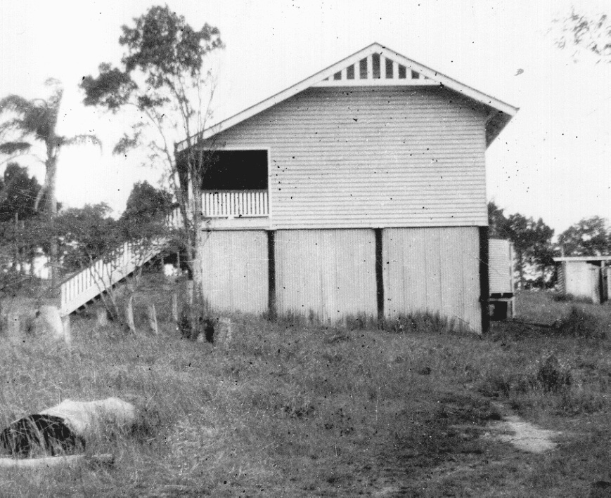
In 1946 Florie and her husband bought a farm high on the hill above Coolum Creek wharf. Florie’s nearest neighbours were 2kms away, and with no electricity or telephone, her only contact with the outside world was the midday news on the battery-operated radio.
She milked cows, fed fowls and collected eggs, hoed vegetable crops grown for interstate markets, helped with the sugar cane, picked pineapples, made jams and pickles, sewed the family’s clothes, boiled her washing outside and cooked meals on a wood stove. The nearest shop, at Coolum Beach, was 5kms away, and the family never owned a car.
As Florie’s parents aged, they retired to Maroochydore, and she travelled there fortnightly to help them. On a Wednesday, her husband would row her a kilometre down Coolum Creek to meet the mail boat from Yandina and she would clamber aboard for the hour-long journey to Maroochydore. She would wash, clean and cook for them, returning on a Thursday – the only day that the boat travelled to Coolum Creek Wharf – and walk to her hill-top house.
I wonder how we would cope if we had to live like my wonderful mother-in-law today!
Memories of World War Two
IT IS almost eighty-five years since the declaration of war in September 1939, and the Coolum and Yandina areas were considerably affected by that conflict. Our district was one of the earliest areas to be involved in a patriotic fervour to help.
The QCWA ladies formed a local Coolum committee for the Australian Comforts Fund, sending books, making long-lasting fruit cakes, and knitting socks, balaclavas, jumpers, scarves and gloves for Aussie participants in what was essentially a European war.
Some local people, (including Fred Fink and his brother Jack, who left on Christmas Day 1940 for Tobruk in the Middle East) were “in the thick of things” in several different places. Fred also served in New Guinea in 1943-44, and in Borneo in 1945.
Not everyone was pleased with the changes in our quiet area, and in November 1939 the Coolum Progress Association complained that people from “… the Military Camp had picketed their horses to the tree guards, and quite a number of the natural shade trees had been (ring)barked, also that trenches had been dug on the frontage and not filled in”.
By 1940-41 however, a Coastwatch station had been set up for the Volunteer Defence Corps (VDC), overlooking Point Perry from the holiday home of the Brisbane-based Grant family. Some early residents in the VDC were Jack Morgan, senior, Fred Stumer, Percy Huet and Victor Marsh.
In addition to those who joined the VDC, Coolum provided twenty-eight volunteers to the Australian Army, Navy and Air Force during World War Two, of whom two, Lance Jensen – a Private in the 9th Australian Infantry Battalion, and Flight Lieutenant Douglas Willet – who flew in the RAAF in England – did not return. Seven of those twenty-eight Coolum volunteers were women, including Private Mabel Barrett, Lance Bombardier Ellen Dobe and Corporal Mona White.
Leicester Peterie, a prominent Coolum resident, unexpectedly served in the U.S. Navy – it was said that Leicester was working in the Garden Island dockyards in Sydney as a civilian refrigeration technician when the American ship on which he was serving was sent to sea. Having a civilian on board in wartime posed a legal dilemma, so Leicester was signed into the US Navy as a Lieutenant and served in the Small Ships Squadron in the Pacific!
Between May and August 1942, a thousand or more troops of the 2/14th Battalion were stationed between Yandina and Coolum, training for the vicissitudes of the Kokoda Track. Nearby, some weeks later, the 2/7th Independent Company of Commandoes spent time lower down the slope, preparing for service in the North-Western area of the New Guinea mountains. I am proud that one of those men was my father.
Some memories of ‘The Devil’
RECENTLY I came upon some memories written in 1980 by a former Coolum State School pupil three years after the 60 Year celebrations of Coolum State School.
Frank Pitt was nine when he came to Coolum in 1932 with his father and twelve-year-old brother, Ernest (known as Ernie). It took them three days to get to Coolum, sleeping under their cart each night. At that time, the Bruce Highway was being built, so much of their journey was made on side tracks, dodging horse-drawn carts with scoops. Frank and Ernie had a six-year-old sister named Doris, but we do not know how she (and presumably their mother) made their way to their new farm, which was described as, “just over the fence” (from the school), which was on the corner of South Coolum Road and Warrack Street.
Young Frank had been given the nickname of “Devil” when he – at three years of age – had hidden under a table with a long lace cloth and he had some bread, some butter, and some syrup, and made a dreadful mess! His new schoolmates soon became aware of the term “the Devil did it”, and the name stuck through his school years.
Frank remembered that one time he “copped the blame” for a misdemeanour, but the teacher, “soon woke up that I was not at school that day!”
Frank reminisced that sport was mainly cricket or rounders for boys and girls, and that he had made the bat that they used, describing it as “cut out with a cane knife from a fence batten or any piece of wood I could find” … In later life he became a cabinet maker, making items “from cots to grandfather clocks.”
He also remembered a very special book prize presented to Coolum State School when they won an Australia-wide competition for a collection of wildflowers … the girls had collected flowers from today’s National Park, just north of Coolum State School, while the boys walked to Mount Emu to collect orchids. It was a proud time for the tiny one-teacher Coolum school!
Frank’s father was also named “Frank Pitt”, and that could be confusing, but eventually less so, because Frank senior left the family on the farm, so as to travel to Chinchilla in western Queensland to work on the railway being built there. Unfortunately, Frank senior later died, and the children worked long days helping their mother on the farm after school. Frank’s memories concluded “I left Coolum pulling a billycart with three beehives on it, to row a boat to Bli Bli … [and] … returned with a wife, four sons, and a Valiant car!
Wishing for summer rains

Recently, there has been a persistent grumble from Coolum residents and visitors because January weather has been so wet, but there were times when summer rain was anxiously awaited and keenly sought. Drinkable water was a scarce commodity in Coolum in the summer months as late as 23 December 1972, when reticulated water from Wappa Falls Dam was finally turned on – one hundred years after Grainger Ward first selected land on the ‘Green Hills’ that is now the township of Coolum.
Until that time, each house in Coolum had at least one water tank, holding some 7000 to 9000 litres, but the camping ground – which attracted so many visitors to the area, had extremely limited access to drinking water. From 1940 onwards, the Coolum Progress Association had been petitioning the Maroochy Shire Council for better water facilities because “the supply at Christmas was very poor, and had it not been for private houses supplying water, the Council may have been involved in heavy expenditure carting water”. Fortunately, by the end of that year, a well was put down beside the Coolum-Yandina Road, and the Council erected a windmill and tank with pipes connecting that limited water supply to the camping area.
The windmill remained an important feature of Coolum for many years, although the water supply was limited, and by the end of 1950, Bob Tickle drew attention to the Coolum Progress Association that more tanks were needed, as “visitors were becoming more numerous every Sunday [and] nothing had been done by the Shire Council in connection with the water supply generally”.
Away from the beach, land on the western side of Toboggan Hill remained as farmland, as at that time it was impossible to safely secure the land on the steep slope – particularly in the area of the Morgan farm, and in mid-October 1966 Coolum residents made a desperate effort to build a dam near the end of Jasper Court, using 50mm polythene piping rather than the standard 75mm pipe. However, they never got to benefit from the new dam because, early in 1967, there was a heavy rain incident that caused the earth from the steep slope above the dam to slide downhill, filling the dam, and obliterating the hopeful dreams of Coolum residents. Jack Morgan Junior once related how he had gone to his kitchen when he woke, only to find that it “had half a hill” in it, following the dramatic landslide during the night! It was not until 1972 that Coolum had the benefit of piped water to homes.
Fortunately, our infrastructure is more stable these days – but residents and visitors still complain about the wet weather!
Going Around in Circles
Many “Sunshine Coasters” are aware that the SS Dicky was wrecked near Caloundra in February 1893 as a result of cyclonic seas. However, few people know that the cyclonic conditions at that time resulted in floods in the Brisbane area which were so bad that the entire Queensland Navy [which comprised three ships!] was washed into the Brisbane botanic gardens, and then washed out again in the resultant floods! Fortunately, the sparse population of the area of today’s Sunshine Coast did not suffer terribly in these cyclones.
However, residents and tourists in our area suffered other cyclones during the twentieth century. In 1947-48, three consecutive cyclones at Noosa damaged the roofs of homes and guesthouses and sent campers frantically searching for shelter. On February 19, 1954 an un-named cyclone – reported as the “worst known blow in 69 years” – ravaged the Gold Coast for 18 hours, and stretched as far as Buderim, where several houses were wholly or partly unroofed. Roads were blocked by fallen trees, banana plantations were flattened, and trees and power poles were blown down. This storm isolated Maleny and Kenilworth districts and damaged buildings, tanks, crops and cattle far inland.
On New Year’s Eve and New Year’s Day 1963, at Coolum, and at other beachside areas, Cyclone Annie wrecked campgrounds from Mooloolaba northwards. People had just started to gather their belongings after the first onslaught when the cyclone came back. This storm affected many campers at Coolum Beach, who were caught gathering their items when chaos began again, losing the lot.
Cyclone Wendy damaged the Sunshine Coast on February 7, 1972, followed a few days later by Cyclone Daisy, causing loss of sand and major flooding.
My late husband, John Windolf grew up in a house on the hill above Coolum Creek, which was very vulnerable in strong winds and storms. He used to reminisce about how his parents would take him and his sister to the shed where they packed the pineapples, just below the brow of the hill, where they would snuggle in wood shavings with their animals until the storm quietened. On one occasion the storm came so quickly that the chooks were left outside – each one walked close to the fence around the house until they came to the corner, where the wind caught them … “cluck, cluck, wheee! … cluck, cluck, wheee! …” Every single hen followed their companions into oblivion!
In the twenty-first century we are well informed about cyclones, because technology has advanced so far – let us all hope that this year will not encircle us with cyclonic weather, and that we have something better than wood wool to protect us!
Gathering socially in early times
Although life in early Coolum entailed long hours of arduous work, and long distances and poor transport made it much harder for people to get together than in our modern world, social activities in the scattered district were much more popular than in our modern world. From 1916 onwards, when dances were held in a converted cottage near Coolum wharf in order to raise money for the building of a School of Arts in which a Provisional School could be established, “Socials” became a popular pastime in the Coolum area.
People came from all around the district to attend “Socials”, with patrons from Yandina, Maroochydore, Dunethin Rock and Maroochy River travelling for hours to attend, and frequently the dancers had to take turns to “step out” of the small building so that others could have a turn at dancing. A newspaper article in the Nambour Chronicle in July 1916 – when the total population of the Coolum district was about 70 people – stated that the first dance held in the makeshift “hall” was attended by 55 adults, and that the old house was “artistically decorated with foliage, flags and lanterns”.
Music for those dancing was very different from today’s music. The School of Arts committee owned a series of concertinas [commonly known as “squeeze boxes”] which they loaned out to musicians on dance nights, and zealously guarded at other times, and these were augmented by concertinas, mouth organs and a range of other items including Aug Stumer’s “kerosinola” – made from an empty kerosene tin – as well as Herb Wintzloff’s saw, and even cornets
At one dance, we are told, Dick Mealing tried to “wear out” the dancers by playing a fast waltz over and over, until one girl “overdid it and fainted”! Luckily, it was later reported that when she “came round” she told him that she would “beat him next time”!
Fancy Dress Balls were very popular, with such striking outfits as Starlight, a Japanese lady, Indians, a ship’s steward, and a clown, with one complicated outfit featuring a pair wearing a costume that represented “the Alliance of Great Britain and France”.
Naturally, all this activity meant that people became hungry and thirsty. The local ladies vied with one another in preparing huge suppers, with cakes, sandwiches, biscuits and other delights – so much food that two suppers were served – one at 9 p.m., and the other at 11 p.m. Leftovers did not go to waste, with anything remaining being sold off for patrons to carry home …as many patrons still had a homeward journey by boat or cart of up to two hours, leftovers were welcomed.
Just watching TV seems boring these days, doesn’t it?
Living through History
Most people, if asked, would define “history” as something in the past – but each of us lives through a piece of history every day – and today’s Palmer Coolum Resort is an excellent example of how history can change immensely through time.
One hundred and ten years ago, in 1913, John Parker selected Portion 502 – the area now bounded by Tannah Street and Warran Road, from the beach to a line roughly between Lagoda Drive and the southern end of Grandview Drive. He built a house on an area that later became the ‘17th green’, where he grew bananas, pineapples and beans to send to the markets in Brisbane, and ran a few cattle. The area had poor soil and was largely swamp, and after Mr Parker sold the farm, other farmers, including the Pollard family, battled to make a living on the block. One family was so poor that they couldn’t afford lunches for their children, and the schoolmaster used to take a cut lunch for them, along with his own lunch.
Eventually, any sort of farming on the site became uneconomic, and from the late 1950s onward the land resorted to swamp and scrub. A series of developers saw potential in the area, however, and it changed hands several times, with each purchaser dreaming of a great financial future for the location. This came to fruition with the Hyatt Regency resort, described by the Sunshine Coast Daily in August 1988 as “This $134 million resort and health spa on 150 acres just south of Coolum Beach … framed by the amazing landmark of Mount Coolum. The resort will comprise a vast array of recreational, health, retail and accommodation facilities – eight swimming pools, an eighteen-hole golf course, nine tennis courts and jogging track and underground tunnel to the five holes on the beach side, where the resort boasts one kilometre of beach front.”
The ti-tree scrub was cleared, thousands of tonnes of soil were transported to the site, a lagoon was constructed where the swamp was deepest, and a world-class championship golf course was constructed in time for the official opening of the Hyatt Regency resort on 15 November 1988. The first guest at the resort was Muriel [Toodie] Pawlick of Yaroomba, a long-time Coolum resident, and author. Official guests since that time included Queen Elizabeth II and the heads of all the nations of the British Commonwealth, at the CHOGM meeting in 2002. One day, my husband and I were asked to take the cousin of the Emperor of Japan on a “bush walk” to see birds around the site!
In 2011 Clive Palmer purchased the site, and “mothballed” it in March 2021 … its history continues!
Radioactive dreams
The late 1940s and early 1950s was a time of hope in Australia, and at one time the entire population of Coolum – about 200 people – dared to dream of fame and fortune because of a ‘wonder element’, considered so valuable for military and scientific purposes that the Australian Government offered large rewards for finding deposits.
George Groth, the stationmaster at Nambour, started prospecting as a hobby, and in 1952 he began prospecting around Mount Coolum. He was amazed when his Geiger counter started ticking near an outcrop of oxidized stone about 200 metres long. It looked like other uranium-bearing outcrops elsewhere, and soon the Nambour Chronicle announced “URANIUM DEPOSITS AT COOLUM ARE FAVOURABLE”!
Later, another article declared “Yesterday Mr. G. A. Groth, uranium discoverer at Coolum … asked me to accompany him, with others, to Mt. Coolum. He had his Geiger with him [he takes it everywhere] and gave some exhibitions of its performance in different places around the base of the mount. The Geiger ticked from 80 a minute to 500, where the “goods” are. Mr. Groth told me that David Jones Pty. Ltd., of Sydney, had a display of Coolum uranium in their show windows and also issued a pamphlet on the subject. Mr. Groth says he is looking for the day when he can get American capital into Coolum.”
For Coolum residents, this was a time to dream – maybe uranium might lead to a bitumen road to Yandina, instead of the often-flooded dirt road. Maybe electricity would come to Coolum at last, and maybe they would have more than one shop… the future seemed wonderful!
None of these dreams of affluence and comfort were fulfilled by uranium though. Instead of Mount Coolum being composed of uranium-bearing rocks, it transpired that the element which set off the Geiger counters was not uranium, but potassium, formed as the peralkaline rhyolite rock [also known as comendite] which forms Mount Coolum broke down in contact with the air, as the sandstone which covered it eroded away. Instead, the Rum Jungle uranium mine, 100 kilometres south of Darwin, which was officially opened by Sir Robert Menzies in 1954, produced uranium for British and American nuclear weapons programs until 1971.
We can only imagine – and shudder at the thought of what might have happened if George Groth’s dream had come to fruition. Instead, the dreams of Coolum residents came true in other ways. We have bitumen roads, we have electricity, we have a multitude of shops, and a lifestyle which is envied in places around the world… and, most importantly, we still have our wonderful Mount Coolum. How lucky we are!
My Favourite Place
I am often asked which is my favourite place in Coolum, and flippantly, I usually say “my home”! However, in the wider sense of place, I know the answer is more important than that. When I first came to Coolum it was the view of the three bays south of Point Perry, because at that time those bays were known locally as the “Coolum Coves – and my original surname was “Cove”!
Point Arkwright has always been high on my list as well – we’ve celebrated there in happy times, and grieved in the sad ones. I remember wrapping my rug around a lad who drowned just off that point when I was recuperating from major surgery in July 1984 – not knowing that at that same time my future husband was standing on top of Mount Coolum, measuring weather data, while snowflakes fell on his shoulders.
My favourite place, however, is on a road, as I drive towards the coast along Beach Road, my soul rejoices as the wonderful view of the ocean suddenly reveals itself in all its glory, and I feel the same joy that many others feel as well. One hundred years ago, in 1923, a South African migrant, resident in Gunnedah, NSW, saw that view for the first time, and it changed his life. Martin Oosthuizen was friendly with the Nowland family who had bought several blocks of land in Coolum’s first big land sale on Boxing Day 1922, and when they came for a holiday in July 1923, he travelled with them from drought-stricken Gunnedah to Coolum – a journey of 1,000 dusty and uncomfortable kilometres. It is said that he took one look at the view from the brow of the hill and declared “This is Paradise – I’m never going to leave here”!
After Martin enjoyed a wonderful holiday, fishing, swimming and exploring with his friends, Mr Nowland reminded him that it was time he packed for the return journey, but Martin replied, “I meant what I said, I’m never leaving here!” and asked his friend to “Go back, sell my farm, and send me the money”! After much discussion, this is what happened, and Martin Oosthuizen remained a Coolum resident from that time.
For many years Martin boarded with Mrs Evans, a widow who lived on the corner of Park Street, between today’s David Low Way and the Coolum Civic Centre. He worked on a number of farms in the area, particularly the farm belonging to the Nowland’s daughter Maud and her husband Jack Smith, and participated in civic affairs through the Progress Association and the Hall Committee. Martin Oosthuizen remained in Coolum until his death, 35 years later!
Which way to Coolum?
When John and I published “An Island Surrounded by Land” in 2004, we were often asked about the title. We would explain that in early days it was so difficult to get to and from Coolum, that living in the area was rather like living on an island. Today we can travel North or South on the motorway or on David Low Way, we can go inland to Yandina and Nambour by road – we can even fly from the airport runway – once part of my father-in-law’s cow paddock!
Although the name “Coolum” was first recorded in 1842, this area was then part of New South Wales and subject to the “Bunya Proclamation”, which prohibited the granting of grazing licences in areas where Bunya trees grew. This meant that in 1859, when the State of Queensland was declared, Canando station, on the north bank of the Maroochy River, and Yandina station [from Coolum Creek to Dunethin Rock] were able to extend towards the coast. When gold was discovered at Gympie in 1867, some gold-seekers followed a northward route, crossing Maroochy River near Dunethin Lake, but the journey was hazardous and most went by ship to Maryborough, not along the coast.
Coolum Creek brought people within 4 or 5 kilometres to central Coolum by boat, but in 1922 Aug Stumer and Chris Wintzloff obtained contracts for a ‘corduroy road’ of cut tea-trees to cross swampy areas between Yandina and Coolum – a difficult journey with the timbers only some 20 centimetres above ground level. Travel on cane trams also became a popular access route. However, by the 1950s the dirt road from Yandina to Coolum was still frequently flooded, allowing infrequent access to the outside world.
In November 1949 it was reported that “an inspection of the track connecting Coolum Beach with the Tewantin-Noosa Heads road” had been made, but this was considered “too costly” and it was not until 1959 that the Bli Bli to Coolum road was opened, on the same day as the opening of the new Maroochy Airport. Some months later the road to Coolum to Peregian road completed the route. 1990 saw the opening of the Sunshine Motorway which allowed Coolum locals easy access to Maroochydore and areas further south. However, initially, until December 1993, this access came at a cost because toll booths were installed at the Maroochy River bridge. The Coolum roundabout and its approaches now see thousands of cars every day, and travelling to the Coolum area has become a hazardous journey
In the 1950s my mother-in-law travelled by boat on Coolum Creek and the Maroochy River as her only access to Maroochydore – today we have many, many choices!
The Greenoaks conundrum
A conundrum can be described as a puzzle that is difficult to solve, and because I have been asked to explain why one of our long-term Coolum streets bears the name ‘Greenoaks Drive’ three times since my last column, I think that it is time to look back on the history of this conundrum!
The eastern end of Greenoaks Drive begins near the junction where Beach Road [which runs inland from the traffic lights opposite Coolum Surf Club] suddenly changes its name to become the Yandina-Coolum Road … are you puzzled yet? Perhaps it is easier to state that Greenoaks Drive is the street which suddenly ducks uphill on the left, almost opposite Perry Street and the Anglican Church, and then runs parallel with Yandina-Coolum Road for some 1.6 kilometres, including a small wooden footbridge, before it ends on the eastern side of South Coolum Road.
But why ‘Greenoaks’? Well, near the beach end of Yandina-Coolum Road, where today’s BP garage stands, the Perry-Keene family had built a home which they named ‘Green Hills’. From humble beginnings around 1906, Green Hills grew and grew, until it sported a fine two-story house, surrounded by a garden and croquet lawns, which became Coolum’s first accommodation guest house. Sadly, one weekend in 1929, the guest house burned to the ground, surrounded by local people and visitors who had seen the smoke and flames from the beach, and had run to see what was happening.
Those onlookers would never have imagined that on the western side of Yandina-Coolum Road, where Yungar Street and Central Avenue meet, traffic lights would be installed during the twenty-first century! A short distance from the lights, where Greenoaks Drive crosses Yungar Street, there is a park with a large area of she-oak trees … the ‘Oak Trees’ that helped give Greenoaks Drive its name – yes, the road travels from ‘Green Hills’ to ‘Oak Trees’!
The ‘Oak Trees’ Park fronting Yungar street is now much used and loved by local children, and it is wonderful to see them appreciating the area, having great fun with their bicycles under the trees. No doubt they have never known that this park is where Coolum’s sugar-cane industry was centred, when cane trams first came to Coolum in 1923 – even in the 1940s and early 1950s, my father-in-law used a ‘German wagon’, drawn by horses – to haul cane to the ‘Oak Trees’ terminal, so that it could be carried to Nambour on the cane trams.
In less than two kilometres, several important features of Coolum history are encompassed in the name ‘Greenoaks Drive’ – why not travel the route and think of its history – it’s an interesting trip!
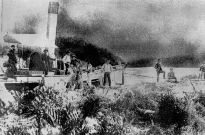
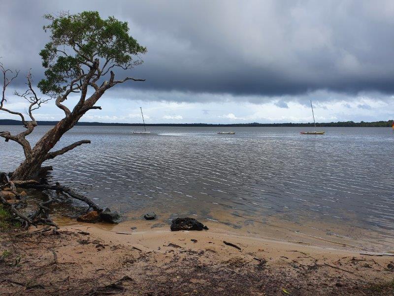
When green hills defined our area

The Tadornah Radjah at Coolum Creek wharf. Photo: Contributed.
Although most Coolum area residents and visitors have been attracted by our blue seas and golden beaches, our early history was built on our green hills and valleys – and they hold an amazing story. Initially, the rolling hills and verdant wallum plains of today’s Coolum area attracted selection for raising cattle to feed miners on the Gympie goldfields. However, cattle don’t eat trees…and there were a LOT of trees on those hills!
Walter Hay junior, who occupied Granger Ward’s “Green Hills” selection from September 1871, listed his occupation in official documents as “timber-getter”. By 1881 he had cleared 24 hectares of undergrowth, with another 8 hectares that had been ringbarked, and in 1883 he freeholded the property. In 1886 Ewan Campbell Low, of Yandina, applied to lease 64 hectares adjoining Hay’s land, roughly along Jenyor Street and Neurum Road, and in March 1891 Robert Coe selected land near where today’s West Coolum Road overpass crosses the motorway. This began the “green gold” era, where timber cutting in the greater Coolum area became an important occupation.
The hills gave up ‘pine’ trees – hoop pines – Araucaria cunninghamii, bunya pines – Araucaria bidwillii, she pines – Podocarpus elatus, and beech – Gmelina leichhardtii, as well as crow’s ash, quandong, sassafras and bolly gum, and all this timber was hauled by bullocks to Coolum Creek wharf, where it was floated in ‘rafts’ of fifty-seven logs, lashed together by chains, to be milled. At ‘spring tides’ – each fortnight at full moon and new moon – the logs could more easily be floated for a day or two to Pettigrew’s sawmill in Maroochydore, where milled timber could be loaded onto ships – particularly the steamships Tadorna Radjah and the Gneering – to be taken to Pettigrew’s Brisbane mill on the Tarshaw. However, Pettigrew’s Maroochydore mill closed in 1898, so from that time until logging ceased in 1909 all of the Coolum logs had to be taken to Low’s Wharf at the end of Wharf Street in Yandina, from where they were taken by bullock wagons to the Yandina Railway Station and thence by train for milling.
It was extremely intensive work, and local indigenous people – both Kabi Kabi and Jinibara – were of great importance, with ‘Donald’ and ‘Martin’, in charge of many other workers, cutting and transporting timber from 1898. In 1901 they were paid ten shillings a load – over $200 today. I once saw a photo of an indigenous raftsman carrying his wife, child and tent on his raft, sharing the week-long journey from Coolum Creek to Yandina. These people helped develop our green hills into today’s important residential area and deserve our thanks!
A bountiful harvest
During the recent NAIDOC week commemorations, I was asked about the foods which would have been available before non-indigenous settlers came to our area – and the enquirer was amazed when I suggested that this is an area where a very wide range of culinary delights were available to our Gubbi Gubbi people from earliest days.
When we think of the Sunshine Coast, we usually think of the ocean, which was a major source of seafood, especially in August and September when “mullet runs” occurred. Gaiarbau, a Jinibara man, described how a ‘lookout’ would hide in beachside scrub until mullet came close, then throw sand-balls to bring them close to the shore, where men with nets of cotton-tree or wattle fibre encircled them. Large middens near Stumers Creek have shown that shellfish were bountiful, and nearby, pigweed seeds were tasty and pandanus fruits could be roasted. Further inland, particularly along Coolum Creek, native ginger provided delicious ginger seeds and red mangroves grew abundantly (although these needed lengthy treatment to be edible), and fresh-water fish and crabs were abundant.
Tall bunya trees grew in today’s Centenary Heights area, although not as plentifully as in the Blackall Ranges, or on the distant Bunya Mountains, where large gatherings from multiple indigenous groups would gather every third year for harvest. On Mount Coolum, delicious “native raspberries” grew, and trees near the mountain offered lilly-pillies, macadamia nuts and quandong fruits. Hollow trees provided ‘Kabbai’, pure white honey, and ‘Ku-ta’, dark honey with a slightly sour taste. Kangaroos were speared in heavily treed areas but in areas with fewer trees they were killed by nulla-clubs, thrown when the animals were in the air, or between hops, when their legs were more easily hit.
Inland from the coast, the clear, fresh water of the upper reaches of Coolum Creek, and other local streams attracted groups of women who dug and treated “bungwall” fern by digging out the stems with sharp sticks, partly drying them in the sun, roasting them in ashes, then pounding them with rocks into a powder, or ‘flour’. At one local site, a few kilometres inland from Coolum Beach, large rocks, hollowed in the centre, and smaller stones which fit those hollows, have been found on a tiny promontory beside the stream at that site. Over the years, particularly in the cane fields, several local farmers have found these ‘grinding-stones’ on their paddocks – the stones have ‘floated’ to the top with regular ploughing. The large stones appear to have been carried from the Blackall Range above Nambour, while the smaller stones come from near our local site.
We are lucky that our area has this rich historical harvest – enjoy it!
Still rolling and caring
From Marcus Beach to Twin Waters and Pacific Paradise, and from Valdora to the coast, our area currently has around one hundred and thirty dedicated volunteers who quietly assist aged or infirm local residents by cooking or delivering some 18,000 Meals on Wheels each year. This service began in Coolum in 1982, largely under the auspices of Sandra Daffy and local doctor, Wyn Lewis, after a meeting held at the Uniting Church Hall.
Jock Edwards [who had been Principal at Coolum State School for many years in the 1960s and 1970s] offered the new Uniting Church kitchen as a suitable base, and a committee was formed, with a roster of people from the Lions Club, the Bowls Club, and the Golf Club, along with other interested citizens, to cook and deliver meals on Mondays, Wednesdays, and Fridays.
The Uniting Church ladies – Jean Wardell, Mavis Turner and Jean Keen, led by Sandra Daffy and assisted by Enid Gruf – used their favourite home recipes, and the first meals – for eight recipients – were sent out on Monday 31st May 1982, and the next day’s Sunshine Coast Daily featured 79-year-old local man, Keith MacIntosh, enjoying a bowl of soup delivered by Lola Hay and Joyce Walker. A wide range of used cooking utensils had been donated by local people from their own kitchens, with other items loaned by Nambour Meals on Wheels. Liquid foods – soup and juices – were carried in large containers, and carefully doled into the recipient’s own bowls and glasses.
By 1985, the number of regular recipients – who received meals on Mondays, Wednesdays, and Fridays – had increased to twenty-two, and Coolum’s local Maroochy Shire councillor had negotiated with the council to lease lot 9, Santa Monica Avenue [now #17] as a base for the Meals on Wheels service, designed to blend in with surrounding homes. The Commonwealth Employment Program contributed $62,000 to the project, and fundraising started in earnest to raise nearly $16,000 to complete the building, as well as extra finance to outfit it. Within 12 months – a year filled with toad races, raffles, art shows, an ongoing weekly “mile of coins” effort, fetes, sausage sizzles, white elephant stalls, chocolate wheels, and other activities – the Meals on Wheels building was opened in 1986.
Coolum Beach Meals on Wheels now provide some 18,000 meals each year, cooked in an excellent commercial kitchen by a qualified chef and volunteers, accompanied by two office staff. Around the district, other volunteers keep Coolum Meals on Wheels rolling on – not just feeding those needing meals, but bringing joy to people who are isolated at home. These wonderful people definitely form an important part of our history!
A hole in our history
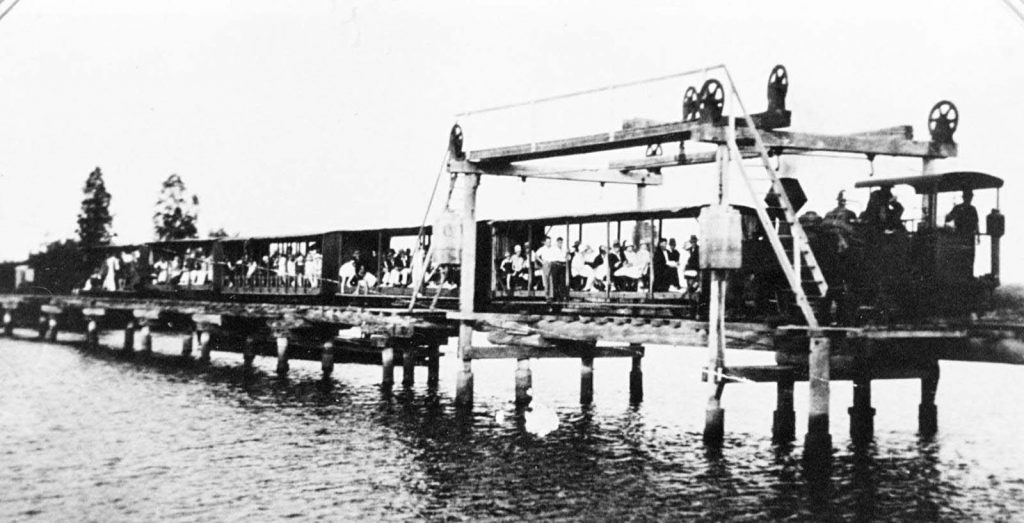
For those who are interested in the history of the Coolum area, this is a sad article, reporting the loss of a feature that has been part of local life for 102 years. The Maroochy River lift span bridge, which crossed the river between Store Road on the north shore, and River Store Road on the south shore, is no more.
The bridge, owned by the Moreton Mill, was constructed in 1921 to connect the cane growing area north of the Maroochy River to the mill’s cane tram transport system in Nambour. Although its purpose was local, designed for carting cane to the mill, by 1923 the bridge made it possible for Coolum residents to travel to and from Nambour in a way which was much faster and more comfortable than travelling on the “corduroy road” of tea-tree logs which ran from Yandina towards Coolum.
It was not long before people from Brisbane came to realise that they could take a train trip at weekends from the city to Nambour, and then transfer to the cane tram for an 11 mile [18 kilometres] journey, winding its way through the cane fields and across the lift bridge towards Coolum. In January 1924 the Moreton Mill purchased the steam loco “Coolum” which pulled four or six passenger coaches. Some of these were enclosed, with covered seats and drop-down glass-paned windows, whilst the remainder had only slat-timber seats and open sides and were protected from the elements by roller blinds. Occasionally the “Eudlo” and the “Moreton” were drawn into service on the Coolum route as well.
By 1927 the passenger trams to Coolum were no longer paying, because of the influence of improved road traffic. By the mid-1930s passenger and freight use had virtually ceased on the Coolum line, and the passenger service was formally discontinued in July 1935. However, although half of the bridge was washed away in 1947, and it was also badly affected by floods in the 1950s, the Maroochy River Lift Bridge continued to be used for cane hauling from the Coolum area until 1953, although cane farming closer to the river continued until the Moreton Mill closed in 2003.
After the closure of the mill, the Lift Bridge remained, quietly mouldering away, in limbo but loved by those who saw it. However, floods in 2022 badly damaged the structure after twenty years of no maintenance, and last month last vestiges of the bridge were removed. Fortunately, thanks to the president of the Nambour Museum, Clive Plater [whose father often drove the “Coolum” over the bridge], parts of the bridge will form an important display at the museum – it will be worth visiting!
Caving in to a misapprehension
Many people in our area are fascinated by the caves in the lower level of Mount Coolum, and recently this became an active Facebook argument, with some people being ‘absolutely certain’ that they were caused by shelling from Australian Navy ships during World War 2. This misapprehension has been repeated many times, but it is totally false. Professor Ewart explains in “Notes on the geology of Mt Coolum” that Mount Coolum – like other local ‘mountains’ – was formed when a volcano intruded into Triassic and Jurassic sandstone 25.3 to 27.3 million years ago, and that it is this sandstone layer which has formed ‘caves’ around the exterior of the dome.
I knew that the ‘caves’ had been in existence throughout World War 2, when the Brooks family lived on their banana farm on the southern side of Mount Coolum – and that there is no way that the Navy would fire practice shells into an area where people lived. However, through the wonderful collection of early issues of the Nambour Chronicle, held in the Nambour Library and online, I found an account of a visit to the area by an anonymous author in 1913, describing the farm beside the mountain, 110 years ago!
This is a much-shortened version of his words … “At the [Coolum Creek] wharf I met two or three residents [including] Mr Albert Ernest Short … I drove with him to his ‘Glen Retreat”. He described how the 65-hectare farm “planted at the foot and at the side of Mount Coolum” grew Cavendish and lady finger bananas, a range of citrus fruits, pineapples, and vegetables, all protected by wire netting, as well as corn and pumpkins, “for the fattening of pigs”. The visitor also met Mr. Chas Green [who] “came to Mount Coolum 22 years ago and was the first to grow bananas and other fruits.” Sadly, Charles Green died the following year, on 14 April 1914, and his body was found in Coolum Creek where it was presumed that “he intended to have a bathe but unfortunately fell in”.
On the second day of the anonymous author’s Coolum visit, it rained, and he was “afforded a sight witnessed by very few strangers” He commented that “The copious rain on the mount fell from the top of the precipitous cliffs in veritable waterfalls…The boom of the surf on the neighbouring beach, the moaning of the wind through the trees, the crying of the mountain which was produced by the wind through its eastern caves … all made an impression to be remembered”.
The Mount Coolum caves tell a story all their own … but that story does not include the Australian Navy!
60 Years of Rolling Bowls
Anyone who has ventured along Elizabeth Street, Coolum Beach in the past few weeks will have seen brightly coloured flags flying and dozens of bowlers rolling balls across pristine greens, as the Coolum Bowls Club hosts top bowlers from across Queensland. This brilliant scene encouraged me to look into the history of this great club, which has now graced Jack Morgan Park for sixty years.
In June 1960 a number of Coolum residents met to discuss a proposal that the burgeoning township should have a Bowls Club. Eight months later – according to Coolum Progress Association minutes, “The suggestion that a Bowling Club be established on Morgan Park was … thrown open for general discussion.”
Several speakers were in favour of an area of land being sold to the bowling Club at a nominal figure without any qualifying provisions being included. However, after considerable discussion, the following motion was put by the Secretary “That the Progress Assoc.[sic] approve and support the Bowling Club’s application to the Maroochy Shire Council, for enough land to build a Bowling Club & two greens PROVIDING that a clause be inserted in the Contract of Sale, that the land cannot be used for any purpose other than a bowling club, and if it should be sold at any time it must be sold back to the Council at the original nominal price”.
However, some residents objected to the use of Morgan Park land for a restricted group like the Bowls Club, and local feelings became strident, with a minute in October 1961 recording that “Since the foregoing Minutes were written, the Progress Assoc. has been in recess for seven months, during which time the books and correspondence have been examined by officials of the Department of Justice. This action was taken because of the dissention and false accusations made against this committee – concerning the proposed Bowling Club.”
Over the next two years, the Bowls Club was a hive of building activity. The club purchased the old Coolum Life Saving Clubhouse for 300 pounds [equivalent to $600] and volunteers worked tirelessly to help rebuild it where it is today, while two local members – Ron Filer, who was an electrician, and Jim Gozzard, who was a plumber – were vital in the construction of the clubhouse. Volunteers had worked tirelessly to establish a single “green” in front of the building.
To the delight of many, the Coolum Bowls clubhouse was the first establishment in Coolum to hold a liquor licence – until that time there was no legal way to buy alcohol in Coolum. No doubt the official opening of the Bowls Club on 2 November 1963 was a well-celebrated occasion!
Our Earliest Tourists
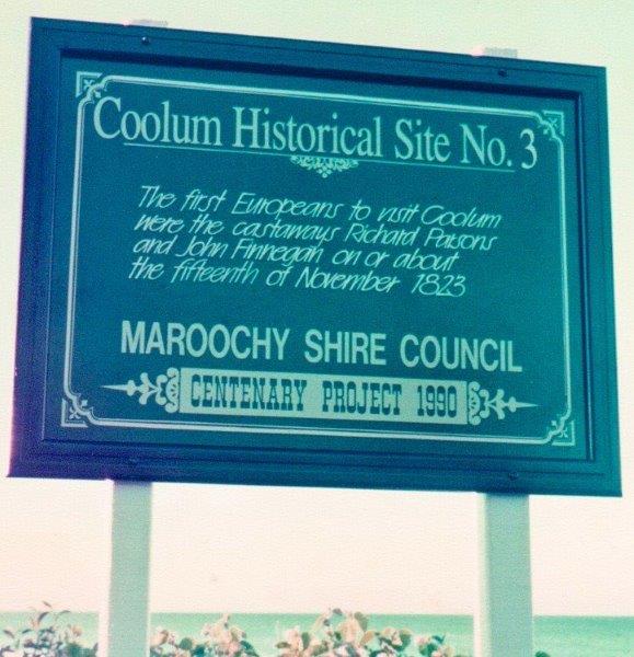
This time of year, is traditionally when local people prepare for a winter influx of visitors to our area … but did you know that our first European visitors started their journey to Moreton Bay and the Sunshine Coast two hundred years ago?
On 21 March 1823, three ‘ticket of leave’ convicts, Thomas Pamphlett, Richard Parsons and John Thompson, accompanied by John Finnegan, a ‘full convict’ – set off from Sydney for today’s Wollongong area in an open boat, 8.8 metres long and 3 metres wide, to buy cedar from timber cutters. In exchange, they were carrying large quantities of pork and flour and five gallons of rum, along with four gallons of water. However, as they neared that area, a storm blew them out to sea for five days.
Hopelessly lost, they drank their water and rum supplies, and Thompson died of thirst. Thinking they were a long way south they turned northward as the weather improved, aiming for the Illawarra area and Sydney. However, they didn’t realise that they had been blown northwards, all the way to today’s Moreton Bay, where their boat was wrecked on 15 April 1823.
Still “heading for Sydney”, the castaways spent seven and a half months walking around Moreton Bay, travelling to several islands, and spending quite some time with the local people at Amity Point. They built a canoe of their own and travelled to Cleveland via Peel Island. In early June they followed the Brisbane River to Oxley Creek and reached Redcliffe by late June. By late September they were living with the local indigenous people on the southern end of Bribie Island.
Early in November, they set off to the north again, still aiming for Sydney. They reached the Maroochy River on 11 November 1823, but two days later Pamphlett announced that he was returning to Bribie with some Kabi Kabi people, while Parsons and Finnegan continued up towards the Noosa area. After arguing, Finnegan returned towards the south, while Parsons walked northward.
On 29 November 1823, John Oxley arrived off Point Skirmish in the Mermaid and took both Pamphlett and Finnegan onboard returning to Sydney. Some ten months later, on September 11, 1824, Oxley proceeded to the spot where he had found Pamphlett and Finnegan the year before and found Parsons there.
Working backwards from 29 November 1823, when Pamphlett was rescued by Oxley, using the narrative he described to Oxley and the crew of the Mermaid, it seems that Parsons and Finnegan passed through the Coolum area on or around 15 November 1823, the first Europeans visiting our district. Their story, with seven others, was marked by historical signs [which unfortunately no longer exist] in 1990.
The Forgotten Man
Although many early settlers in the greater Coolum area are well-remembered in our historical lexicon, the second person to select land in the area has been long-forgotten in our history. Mark Blasdall selected 252 hectares adjoining Coolum Creek, near the junction of the Maroochy River, as early as 1881. This area, which was designated as Portion 93, was specified as a First Class Pastoral Lease, which was meant to encompass an area of grazing land, but Mark Blasdall had other, larger, ideas for his Portion, as you will see further in this article.
To understand Blasdall’s activities, we must first look back on his fascinating life. He was born in Nottinghamshire, England as long ago as 1841, and travelled to Queensland with his parents and other family members on a sailing ship, the City of Brisbane in 1861. His father was first employed by a pioneer of the Queensland sugar industry at Ormiston Point and then took up land on the Brisbane River at Indooroopilly Pocket. Mark had a real thirst for adventure, and when gold was discovered at Gympie in 1867 he and his younger brother, Frank, walked from Brisbane to Gympie to seek their fortune.
After Mark Blasdall’s parents died in 1876, he became the owner of their property and added to it considerably, but apparently, he was attracted to the Maroochy River/Coolum Creek area, where, from 1881, he planted sugar cane (the first cane in the Coolum area) and cut timber, as well as grazing cattle on his First Class Pastoral Lease. He had two huts on his leasehold, and he operated a small sawmill near the river – until thirty or forty years ago there were still signs of the wooden tracks leading from his mill to the river, where – after he had cleared Coolum Creek of underwater obstacles – steamships could enter to deliver supplies and load timber.
However, despite his hard work, Blasdall was declared insolvent in 1884, owing hundreds of pounds to the Lands Department for rent, and thousands of pounds to the Queensland Mercantile Agency for sawmilling equipment. At that time, he made a Statutory Declaration that he had already planted eight hectares of sugar cane, but this is doubtful, remembering that clearing and cultivating land, and cutting cane was very slow work when everything was done by hand!
On August 27 1884 Blasdall’s Coolum Creek land was free-holded and was subsequently transferred to Emma Simmonds Bailey on 26 November 1885. He returned to the Indooroopilly farm, where he lived with his wife and six children, remaining there until his death, at 95 in 1936.
How do I know all this? My husband and his sister grew up on Portion 93!
When Coolum was green
If I asked you to quickly list the first three colours that describe today’s Coolum, I wonder what they would be. The blue of the sea? Yes! … The gold of the sand? Yes! … and “Ummmm!” … Where red roofs abounded in the past, now white or grey are predominant colours – but in the early days, Coolum was definitely GREEN! In fact, Coolum was settled because of its verdant green hills!
Further north, at Gympie in the late 1860s, the colour that was eagerly sought was a different, more lucrative gold, and miners rushed to that area from 1867. However, you can’t eat gold, and two years later enterprising pioneers, Grainger Ward and Walter Hay selected land in today’s Noosa-Tewantin area to graze cattle to sell on the goldfields. Seeking more land for his stock, Ward looked southwards from Noosa Head and saw verdant, unused hills, and on September 20th 1871 he applied to have an area of one square mile [225 hectares] of land surveyed. He was granted a conditional Second-Class Pastoral Lease which was registered as Portion 169, and named it Green Hills! This is the area now bounded by Banksia Avenue to the north, School Road and South Coolum Road to the west, Jenyor Street to the south, east to Wattle Street, and then north again to First Bay.
It was a condition of Ward’s lease that someone must live on the property, so he arranged for Walter Hay’s son Walter junior to occupy the selection [Portion 169, Green Hills], thus making Walter Hay junior the first non-indigenous resident of the Coolum area. By 1881, Ward’s selection had a two-room house, with a stockyard and necessary fencing for stock. 24 hectares of undergrowth had been cleared, eight hectares of trees had been ringbarked, and more than 300 cattle had been run on the property at various times.
In March 1882, Walter Hay junior applied for the lease to be transferred, and it was free-holded to him in July 1883. In May 1885 Walter Hay junior sold Portion 169 to a syndicate comprising Lawrence Cusack, Roderick Morrison, Theobald Hogan, James Smith O’Donohue, and Patrick Joseph Byrne. Over the years the syndicate changed several times, and eventually, it was bought by Magdalene White and her daughter Piercy Maude Perry-Keene in 1906.
In the 1940s and 1950s, there was a ruined set of stockyards in the flat area between today’s Malibu and Santa Monica Avenues, which had been there as long as the Perry-Keene’s 1920s dairy stood there. It was always thought that this was the site of Walter Hay junior’s home and stockyards … perhaps the very green centre of Coolum!
Where is Black Gully?
I have recently realised that there are a number of places in our district which have – with time – changed their names, confusing newer Coolum residents and visitors. One of the strangest was on an old shipping chart drawn by Thomas Ham in 1871, which marked the ‘Halfway Lump’ on our coastline… we call it ‘Mount Coolum’, and I, for one, am glad that I don’t have ‘Halfway Lump’ as my mailing address!
The changing of place names sometimes confuses people, and it can be hard to see the reason. However, recently when I was asked where ‘Black Gully’ is and why it is of importance in Coolum history, I explained that Black Gully – a small creek, thought to be named for the colour of its waters – is situated in Birrahl Park at Yaroomba, one of the most historic areas in our district, reached by Yerranya Row or Goongilla Street.
At Black Gully, there is a lookout marking the spot where, on July 19, 1862, the “Kirkdale”, a wooden “brig” [a style of ship, about 30 metres long, with two masts and square-rigged sails] was wrecked on the beach at Yaroomba – apparently, it had turned back while sailing to Ceylon [today’s Sri Lanka]. It is possible that the cooking stove on the ship had caught fire, and the crew steered it onto the sand, where a small creek curled around and meandered across towards the ocean. Some lifeboats from the wreck were saved, and the captain and five of the crew rowed to the pilot station on Moreton Island while the rest of the crew made their way towards Brisbane, some on foot and some possibly in a couple of smaller boats. The next day an American barque named the “Phoenix” sighted the still-smoking remains of the ship and steered shoreward to investigate. The ship’s master saw a group of indigenous men trying to launch a boat from the wreck, but no other sign of life, so he sailed on towards Brisbane.
There is a lookout at Black Gully from which you can sometimes – after very heavy rains – see where the remains of the “Kirkdale” lie. The remains are protected by Australian shipwreck laws and must never be removed from that place.
In Coolum Library, there is a large, oaken rib that was removed from the “Kirkdale” at Black Gully by a Nambour resident some fifty years ago – before these laws were made. Protected in a glass case with permission from the Australian Government, it is interesting to see this historic piece of timber studded with iron and brass bolts, which has such a fascinating past.
When all things were difficult.

Recently I read that ‘All things are difficult before they are easy’, and my thoughts went back to the Coolum of a century ago. In 1923 there were fewer than 100 people living in the greater Coolum area which included surrounding farms, the only road into the area was a ‘corduroy road’, made of cut-down tea-tree trunks laid side-by-side on top of the ground, and almost all goods were brought to Coolum by boat along the Maroochy River and into Coolum Creek.
From 1910 or 1912 it was realised that the swampy pastoral land to the west of Coolum would be ideal for farming sugar cane if the thick covering of tea-trees could be removed, so that drains could be dug to carry the prevalent swampy water to the river. A quiet hero of this time was Henry [Harry] Dobe, who had come to this area from the Northern Rivers district of New South Wales, at the behest of Harold Perry-Keene. Day after day, and year after year, Harry Dobe dug drains, through areas of the Coolum/Valdora and Yandina Creek swamps, where the tea-trees had been cleared by local workers, who had chopped each tree down with an axe, then chopped through the roots so that the stumps could be removed.
Once the area was cleared, Harry Dobe set to work with a shovel, removing the mud and throwing it up to form a bank on one side of the drain where it would form a dike in flood times when water was high. Each drain was about two metres wide and a metre deep, and Harry used to say that he had to dig about twenty metres a day for his work to be a paying proposition.
However, Harry Dobe didn’t live his difficult life alone. He was newly married, and from the beginning, Harry took his wife with him, putting up a rough canvas tent beside whichever drain he was digging at the time. Every few days, Mrs Dobe would pack up the camp and move along the drain, while looking after their family – which grew to a total of six children, each of whom eventually attended the Coolum Provisional School, where Flora, the eldest child, was a first-day pupil. These days we just cannot imagine how the family managed, living under a strip of canvas, carrying all their tools, their supplies – even their fresh water – on their backs, while they traipsed through mud, slush, heat and swarms of mosquitoes.
Perhaps, today, we would think that the Dobe family lived an impossibly difficult life, but in 1923 they were considered wonderful citizens of our town – they left a wonderful legacy!
A different place to live!
In 1946, when my late father-in-law, Alec Windolf, brought his family to live on a farm adjoining Coolum Creek wharf, there were many elderly north-shore men who had led interesting lives, virtually as beachcombers. One of these, Hans Boysen was so notable in the Mudjimba area that an avenue of fine homes now bears his name.
Hans, however, had a much more unusual – and much less salubrious – home. He never built himself a hut to live in, or even a roughly built humpy, but instead became a master recycler. His home was fashioned from an old ship’s boiler which had washed up on the shore and lay there, rusting away. He believed that the plentiful coffee-rock surrounding his unusual home hid a source of oil, and he set up a hand-operated drilling rig which he used to drill behind the sand hills in an effort to prove the truth of his theory.
Because Hans was German by birth, he attracted a lot of gossip during the Second World War. Many people thought that he was a spy, trying to cover his nefarious acts of contacting enemy vessels through his oil-drilling activities. However, there was no evidence that this was so, and Hans was allowed to remain at the site throughout the war, without being interned, as many other Germans were. It was said that he was under surveillance during this time, although that theory has never been proved. The nearest accessible police stations were at Nambour and Tewantin [there was certainly no easy access to Maroochydore at that time] and police officers would have had a rough journey of several hours each way to reach his camp, on foot as there were no trafficable roads along the coast. My father-in-law [whose German ancestors had come to Australia more than seventy years before that time and spoke no German] met and talked with Hans occasionally when searching for cattle that had wandered from the part of the family farm, across the northern end of today’s airport land.
By 1947 Hans apparently realized that his search for “Black Gold” was futile. He loaded all his worldly possessions onto a wheel-less wooden “slide” behind his horse and headed for the railway station in Nambour, telling the people he knew that he was going to build a new life in Rosewood, where he was going to mine coal.
However, Hans Boysen’s story had a sad end. When he arrived in Nambour and headed across Currie Street – the main street in Nambour – to the railway station, Hans was struck by a car. His injuries were great, and he died almost immediately, all of his dreams coming to nought.
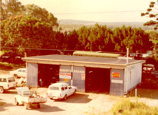
Murphy’s Garage
When I first moved to Coolum in January 1985, I was puzzled because so many people used “Murphy’s Garage” as a point of reference, using phrases such as “turn left just before Murphy’s Garage” or “get your tyres checked at Murphy’s Garage” … but I couldn’t find “Murphy’s Garage”, no matter where I looked! As I came to feel at home here, I discovered that the garage had changed hands, but was so important in local folklore that long-term locals still used the former name. The site is now known as the BP Garage.
Murphy’s Garage had been built in the 1950s, in the area where Grainger Ward had selected Portion 169 in September 1871 – now bounded by Banksia Avenue to the north, School and South Coolum Roads to the west, Jenyor Street to the south, and back to First Bay. The garage was not the first notable building on the site, because the Perry-Keene family had chosen that spot for their home “Green Hills” in 1906. “Green Hills”, which eventually became a guesthouse, was destroyed by fire in 1929.
In 1954 Claude and Daisy Murphy drove through floodwaters to Coolum Beach, on holiday from Proston. As they drove towards the ocean they fell in love with the view, and immediately bought two allotments at 100 pounds [just over $1,000] each, and had a house built opposite where the service station now stands – the original house took only three weeks to build! In 1957 Coolum became home to Claude and Daisy, and their son John established Murphy’s Garage – until then, Theo Chapman had repaired a small number of cars in an area behind today’s Coolum Caprice, but Murphy’s Garage was the first full-blown service station.
John Murphy – who, at 89 years old, now lives at Yandina Creek – reminisces about the day when he saw “a girl in a big red hat” frantically riding a bicycle in a storm. That girl was Caryll Windolf, and after another home was built adjacent to the first Murphy house, the young couple married in 1960 and had four children, all of whom went to Coolum State School.
Murphy’s Garage was not only a petrol station, but repaired all sorts of vehicles, and – at a time when Yandina hosted the nearest repair shop – played an important role in the Coolum community, and was an assistance centre for locals and visitors for some thirty years. In the 1980s, the older men of the district, who would gather there to chat, passed on many, many stories, newspaper clippings and memorabilia to my husband, John Murphy’s brother-in-law, and it is these which form the basis of our historic knowledge of the district today.
In the mail …
During the last few weeks, our streets have been busy with mail deliveries, and our Christmas festivities have been enriched by the mail we received. After one ‘postie’ delivery, a friend enquired about early postal service in the Coolum area, which led to some interesting details.
The first mail depot in the Coolum and North Shore area – between the Maroochy River and Noosa – was established in 1892 on John Lunn’s farm near the intersection of the present David Low Way and Godfrey’s Road, about a kilometre east of the Bli Bli bridge. It bore the grand title of Coolum Receiving Office, but there was no direct access to today’s Coolum area where Grainger Ward, a pastoralist at Gympie and Tewantin, had, in September 1871, selected a square mile [225 hectares] of the “Green Hills” that could be seen from the Noosa area.
Because there was so little road access to Coolum, virtually all mail to the area came by boat via Coolum Creek until the 1920s. It was not until 1924 that a distribution centre for a ‘Free Bag Service’ was established near the beachfront by storekeeper Fred Morrison. This was a very short-lived proposition however, and the Morrisons had left Coolum by 1925-26. A new Receiving Office was opened for mail around this time, and records show that it was elevated to a Post Office [in] April 1926/27. This service included not one, but two telephone exchanges in the area, with Coolum Beach having six numbers listed, and the Coolum exchange [run by Joe White from his home at ‘Salaita Hill’, near the corner of today’s Centenary Road and Warrack Street] served the farmers in the area of Mount Coolum and Point Arkwright for three hours a day, from 9-10 am, 12-1 and 4-5 pm. In 1931 the newly-established Country Women’s Association branch moved a motion to ask the Department of Posts and Telegraphs for “a telephone Silence Cabinet to be built at the Post office”.
The two-storey building which many Coolum people remember as ‘the old Post Office’ was built as a hall and café, as well as a manual telephone exchange. Miss Speer and Miss Biltoft [later Mrs Sneesby] were well-known telephone operators there, and many Coolum people fondly remember Mr and Mrs McGinty, who ran the Post Office in that building in the latter half of the twentieth century. By 1976, all houses in Coolum were numbered, and postal delivery services commenced early in December 1976.
It is hard to estimate the amount of mail that goes through local Post Offices today – I, for one, deeply appreciate our ‘posties’, and thank them for their service!
Rejoicing with Christmas lights!
As I write this column, I’m wishing every reader a very, very happy Christmas – as happy a celebration as Coolum people celebrated sixty-six years ago!
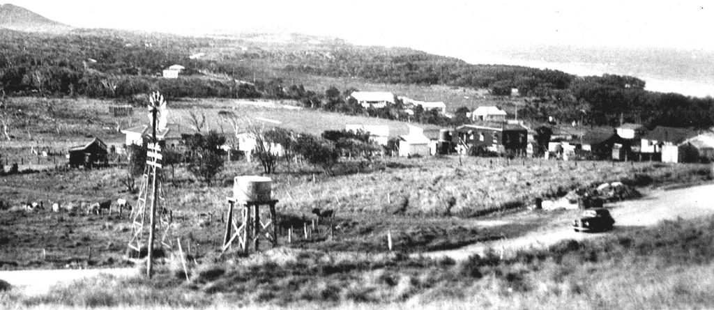
Christmas 1956 was a very special occasion in Coolum Beach, bringing light and joy to ninety-three local households, and the hope of similar light and joy to residents in the larger Coolum area – light and joy that had been a very long time coming! On 22 December 1956, Coolum Beach [the area now called “Central Coolum”] celebrated when electricity was first turned on in the township, with 93 subscribers in the initial connection.
In June 1937, the Coolum Beach Progress Association had voted to support a “bid for Electricity for the North Coast” that would give a service such as that in Nambour [which had its own electricity scheme that was “so successful that it attracted a take-over bid from the Brisbane-based City Electric Light Company” in 1935, and we know that Yandina “had not long had electricity” during the war years, but despite all efforts of the Progress Association, supported by others from outside the area, such as Mr D.A.Low, M.L.A. and Mr H. Baskerville of the Maroochy District Electric Light Development Association, surveys were carried out but to no avail.
John Windolf, my late husband, who grew up on a small hill just southwest of Mount Coolum, used to reminisce about the time when he could stand on that hill and not see a single electric light! Maroochy River, Bli Bli and Valdora got power in 1952, but Coolum still missed out, largely isolated by the farms and swamps surrounding the Coolum township. Electricity wires to Coolum Beach had to be brought from Maroochy River, via Coolum Creek and South Coolum Road, and sadly this meant that many houses had electricity poles erected, but had no connection to the grid for a month or more after electricity arrived.
Within the Coolum town area, some buildings were wired months ahead, by the Southern Electric Authority, and as time went on Ron Filer, an electrician from Nambour moved to Coolum and wired many buildings. People’s needs were simple – the QCWA branch installed four lights and one power point in their cottage, and the Memorial School of Arts, which originally planned to have ten lights and one power point, daringly added another three lights and two more power points, including another
powerpoint for the Picture Show Operator.
It is almost impossible to imagine living in a house with four or five lights and a power-point or two, but what a happy Christmas it must have been for Coolum residents – I wish you as much joy as the residents of 1956 celebrated!
Christmas memories – at a different address!
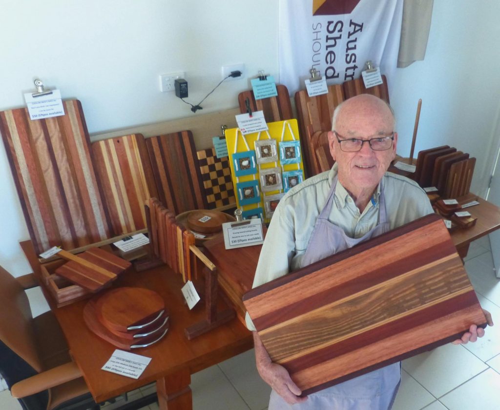
Each year, as Christmas comes around, I look for special gifts for family and friends, and usually find wonderful gifts at the Coolum Men’s Shed at the Coolum Industrial Estate … the stylish cutting boards, bowls, and other items made by Men’s Shed members are greeted with joy by those I love. Although my history articles tend to look back over more than a century of Coolum life, the more recent, ten-year history of the Coolum Men’s Shed is worthwhile noting as well, especially when we consider that so much of our Coolum historical records have come from a group of elderly men who would gather at Murphy’s Garage in the late 1970s and early 1980s, to chat about “the good old days”. They passed on many wonderful photos, newspaper clippings and favourite stories, and our history is richer for their remembrances.
Ten years ago, in October 2012, a meeting was held in the Coolum Lions Club Hall, with a three-man steering committee of local men – Russell Lunn, Frank Bates and Vince Amor – who were members of the Nambour Men’s Shed, some representatives of the Lions Club, and thirty-two local men from the Coolum community. The Lions Club helped the new organisation with a $1000.00 donation, and the new group became affiliated with the Australian Men’s Shed Association.
From those beginnings, the Coolum Men’s Shed has gone on to be an important part of the Coolum scene. Initially, the group leased premises in Junction Road in the Coolum Industrial Estate, and used donated, loaned and ‘scrounged’ materials to make items for the Coolum Amateur Players, possum and bird boxes for Coast Care, and made or repaired a wide range of items for local organisations and individuals. In 2015, when the Coolum Men’s Shed was awarded the “Community Group of the Year” at the Australia Day awards ceremony, the group moved to other premises in the Industrial Estate, and then on to another site in Toolborough Road. In 2016 the Coolum Men’s Shed built a permanent home – brilliantly “fit for purpose” – in Research Avenue.
Here the Coolum history link continues – in December 2018 Maroochy Shire Council delivered the original 1950 Coolum Beach Memorial School of Arts building to leasehold land next to the Coolum Men’s shed. Most long-term Coolum people would remember that this building was known as “the Picture Theatre” and was later situated in Jack Morgan Park. Since then, Men’s Shed members have refurbished that building, which is now used by them, the Coolum Women’s Shed, and other groups. The old cinema now has a new movie projector and is used by local musicians as well. “What goes round, comes round!”.
“Schoolies” was different then!
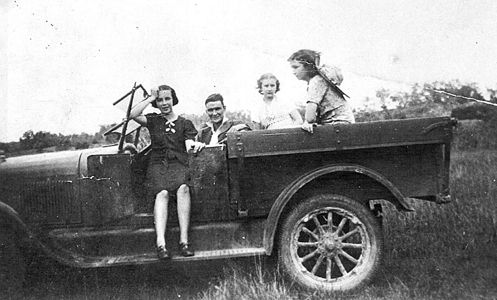
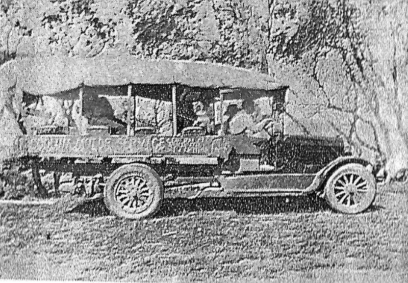
Coolum and North Shore history owes a great deal to Jack Morgan junior – the son of Jack Morgan senior, Coolum’s first Lifesaver and, later, our first Shire Councillor. Born in 1918, Jack junior, who never married and never aspired to the civic heights of his father, has blessed us all with his collection of Coolum photographs which he passed on to us before his death in mid-1992.
Today’s photograph is my favourite of all Jack’s photos. It was taken in 1938, when he was 19 or 20, and quite “the lad about town”. Unfortunately, Jack’s companions in his car were never listed, but it is thought that his young sister, Mildred, aged about thirteen, sits on the far side, and the others could possibly have been Ida Wintzloff, who would have been sixteen at the time, and/or fifteen-year-olds, Ellen Wintzloff, Jean Dobe or Edna Spackman.
All of the group had been pupils at Coolum State School – a purpose-built building that was opened on the hilly corner of Warrack Street and South Coolum Road on 22 August 1930, to replace Coolum’s first school, the Coolum Provisional School which had shared the Coolum School of Arts hall since April 1917. The 1930s were a difficult time for schooling in Coolum, as the Great Depression led to a constant stream of people coming to the tiny Coolum village, looking for work. Many of these people only stayed a short time before ‘chancing their luck’ elsewhere and moving on. A total of six different teachers – five women and one man – took on the role of the sole teacher during that decade. Those teachers taught a total of 96 different students, aged between five and fifteen, during that time!
By 1938 Jack Morgan junior was the proud owner of this vehicle, although he was limited as to where he could drive it. There was a ‘corduroy road’ between Yandina and Coolum, but this was constructed only of cut-down tea-trees, laid side to side on the surface of the ground, raising the level by about ten centimetres – well below the surface in wet weather. If he wanted to drive to Maroochydore he had to drive west to Yandina, south to Palmwoods and east to Maroochydore, and the journey to Noosa – via Yandina and Cooroy – was similar. Consequently, Jack, ever resourceful, would lower the air pressure in his tyres and drive to Noosa along the hard-packed sand, usually accompanied by a group of young ladies!
“Schoolies” was an unknown activity back then – but we can be certain that Jack and his friends – although more limited in their entertainment – had just as much fun as today’s young people are enjoying!
Joseph Dixon’s holiday house
Joseph Chapman Dixon on Coolum Beach circa 1912.
THESE days, many people enjoy holidays travelling long distances by car, plane, or even on ships, but in earlier times a trip to a family “holiday house” was favoured. The first known holiday house in Coolum was built in 1912, a year after Robert Abbott surveyed Portion 169 in Coolum, on a site just north of today’s busy traffic lights.
Prominent Buderim resident Joseph Chapman Dixon selected land on Buderim Mountain in 1870, taking advantage of the rich red soil where stands of red cedar and white beech trees had been logged during the previous decade.
Dixon initially ran cattle on three adjoining portions on Buderim, but by 1874 was cultivating maize, coffee, and sugar cane. Newly married to Elizabeth Alice Fielding, he and his father-in-law, John Fielding, then had a sugar evaporation boiler transported by bullock wagon to the area, and by 1881 they were some of the largest landowners in the area, with nearly 700 hectares, largely worked by South Sea Islanders from Tanna in Vanuatu.
Joseph Dixon and his family were Quakers [also known as the Society of Friends] and were known for treating their workers with kindness, and he opened a school for the children of his Islander workers, as well as being active in establishing a provisional school at Buderim Mountain in the mid-1870s. By 1885 government legislation curtailed the use of South Sea Islanders on sugar plantations and most Buderim Mountain sugar growers started to grow alternative crops, but Joseph Dixon continued growing sugar cane on a commercial scale until 1896, when he closed the mill, he had operated for some twenty years.
However, Dixon, looking forward, had prepared for this situation, and had bought land at Flaxton on the Blackall Range, behind Nambour, where he had developed coffee and orange tree plantations from 1892. This did not fulfill the active life he loved, so he then moved to Gympie, becoming well-known in the boot trade in much the same way as his brother, Thomas Coar Dixon, who was a prominent boot manufacturer in Brisbane.
After more than a decade in Gympie, Joseph Chapman Dixon and his wife returned to the Flaxton area around 1903. They were visited often by their three daughters and two sons and their families, and it is easy to picture them looking towards the coast at Coolum and planning to build a home there one day. Joseph Chapman was seventy-one when their holiday house was built and it is wonderful to think of his family travelling down the Maroochy River from Yandina, travelling from Coolum Creek wharf on a wagon, and rejoicing in their new holiday home. He enjoyed that house for another seventeen years.
An Exemplary tale
MANY of the articles I have written for the Coolum Advertiser are centred on Coolum because this was the centre of population in our area, but there are other places in our locality that have an interesting history. One of these is at Lake Weyba – an area that can be reached by travelling eastwards from the Sunshine Motorway, along Eumarella Road – where a large and very active commune was established in the early 1890s.
In October 1893 a ‘Co-operative Communities Land Settlement Act’ became law in Queensland, and by the end of that year a group comprising 237 people, including 59 men, was given an area of just under four thousand hectares and a grant of nearly $112,000 [in today’s terms] to farm at Lake Weyba, in the parishes of Weyba and Maroochy, with rent paid annually for ten years.
This group, which was called the Woolloongabba Exemplars, was largely made up of people who had been made homeless by three severe Brisbane floods early in 1893, and who worked under communal principles, whereby “all the lands, tools, stock, and appliances, as well as improvements, shall be held as common property in trust.” As far as possible, the members should “produce all their own requirements – building homes, producing their own vegetables, grain, and fruit” and “tanning their own leather, raising their own wool, and cotton”. They should share finances and the division of labour equally.
By May 1894, the group had “a substantial store and other smaller buildings” and had cleared two acres [nearly a hectare] of stumps from the trees which had been cut down and had also established a large garden. Despite this, the group had split into two sections, with one group remaining at Lake Weyba, and the other moving to Yandina Creek. By the middle of 1894 “substantial cottages” were being built at Lake Weyba, as well as a sixty-foot [roughly 20 metres] jetty, a smokehouse and drying shed for curing fish. Roughly a hectare of land had been ploughed so that oats could be planted, and a school was being built. At the Yandina Creek settlement potatoes were being cultivated in a fenced area, opposite a “strongly built house with chimney and bark roof” and nearly five hectares of scrub had been cleared.
By September 1894 however, the group was reported to be “on its last legs”, largely because “the land was wallum flats that would not feed a bandicoot”, and by December 1894 the group was declared “defunct”. By December 1895, only five or six families remained at Lake Weyba.
Today, Lake Weyba is considered a beautiful recreation area, rather than a communal farm, but its history is worth remembering.
Doreen’s story
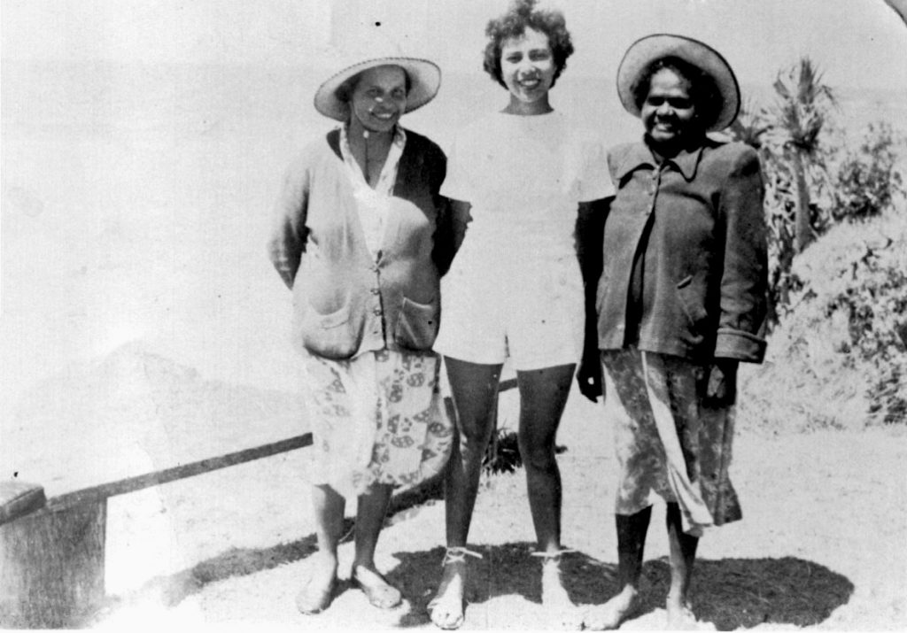
Doreen Monkland was a much-loved member of the Coolum Beach community, arriving sometime after 1910, living here for more than thirty years, and visiting often after that. She originally came from Tuchekoi, between Cooroy and Imbil, and her story is fascinating.
Doreen’s family were indigenous members of the Gubbi Gubbi language group, and her sister – Evelyn Serico – later recalled that around 1910, their uncle had been caught drinking with his friend, a publican. At that time the possession of alcohol by indigenous people was forbidden, and a few weeks later a group of police arrived with a buckboard cart and took the entire family to the jail in Yandina. The next day they were put on the train to Murgon and forced to live at the Cherbourg settlement where they were trained to be servants to white employers across Queensland.
When she was just twelve years old, Doreen came to live in Coolum as a servant to William Perry-Keene and his wife, Piercy Maud Perry-Keene at “Green Hills”, the large house they had built on the site where today’s BP service station now stands. The home, which burned down in 1929, became a guesthouse in the 1920s, and Doreen’s duties not only involved kitchen and other household activities but also included selling cool drinks to people travelling to Coolum as passengers on the cane trams at weekends. However, the position she most valued was being nursemaid to the Perry-Keene children, who loved her very much.
After I wrote ‘An Island Surrounded by Land’, I was asked to visit an elderly lady, formerly of Yandina Creek, to visit her in Nambour. She was blind, but her carer had read the book to her, and she wanted to share her reminiscences. She told me that when she was twelve, she had been asked to help at “Green Hills” in the busy summer season because some of the family had caught the measles and they were short-handed. This lady remembered that every morning Mrs Perry-Keene kissed Doreen “good morning”, and every night she kissed her before she went to bed.
Doreen Monkland was fortunate, in ways that many other indigenous people were not, in that she was loved and cared for, became a popular member of the Coolum community, and continued to spend time with her indigenous family – particularly her sister Evelyn Serico, and her niece Dr Eve Feisl as well. She frequently took local friends to Mount Coolum, sharing stories indigenous to the area, but also loved tennis and travelled to Melbourne every year to watch competitions there. Doreen should be recognised as an important citizen of our town – remembered with great respect.
Local Scandinavian history
I RECENTLY took some interstate friends to one of my favourite places in the Coolum and North Shore area and reflected that I had never seen other visitors at this special site. This special site celebrates the activities of a group of residents whose families migrated to this area from far away, from the other side of the world. Finland Road, on the western edge of Marcoola, is a narrow strip of bitumen that used to be edged by large, highly productive, areas of sugar cane – now, with the inevitable march of progress, it edges the outskirts of the Sunshine Coast Airport, and leads to an attractive tree-shaded park which sports a large, open-sided shelter which was built for the groups of migrants from the Scandinavian country of Finland, and their descendants.
At the entrance to the park a tall memorial, designed and made by Finnish artist Marti Vaananen, commemorates those who have migrated from Finland to this area of Australia since 1896. This memorial was unveiled by the Finnish Ambassador on April 6, 1997, and the reverse side commemorates the persons, organisations and companies who have made monetary donations towards the Memorial and Park. These donations came from far and wide – from the Sunshine Coast Finnish Social Club, from Mt. Isa [where many Finnish people worked in the mines until they could afford to buy farms], from Tully, Brisbane, Sydney, and from firms such as the Finnish Kone Elevators and even from the Embassy of Finland.
From about 1900, Mr G.L. Bury of Nambour offered Finnish people seven-year leases over land at Image Flat near Nambour, where they could clear the land, build homes from the timber, and at the end of their tenure, either buy their farm and live on it or sell it. In later years, particularly after World War 2, Finnish farmers such as the Suorsaari’s and the Savimaki’s became excellent sugar cane farmers.
After World War 2 my father-in-law, Alec Windolf bought land adjoining these cane farms, and the runway of today’s Sunshine Coast Airport runs across all three of them. “Pa” [as I called him] had successfully ridden a motorcycle as a Military Policeman in World War 2, but never ever drove a car or a truck. He used to tell the tale of how he went down to “The Finns” and bought a pair of work horses, which he proudly drove home to his house above Coolum Creek. When he got there, he called “Whoa” [which was the usual term for ‘Stop’ for horses], but the horses kept going … Next morning, he harnessed them again, and called “Giddy-up”, and they just stood still – his new horses only knew Finnish!
Brushed by royal memories
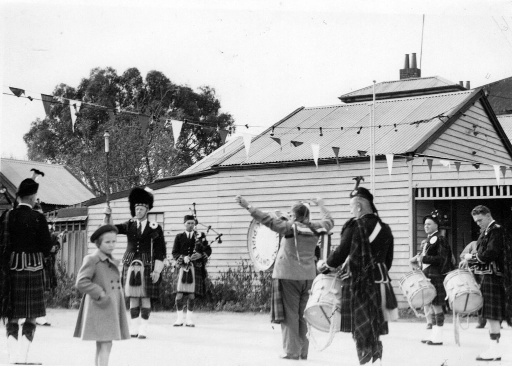
QUEEN Elizabeth II’s recent death has brought a range of memories to people across our nation, and it has made me feel old! I am like most residents of the Coolum and North Shore area, in that I have been brushed by a range of the royal media stories which have confronted us, and I believe that most of us have a royal memory or two lodged somewhere in the back of our brain.
Last month I recalled the Queen’s 2002 visit to Coolum, and there are many local people, now in their forties, who vividly remember waiting for hours outside Coolum State School to greet Prince Charles and Princess Diana on their 1983 Sunshine Coast visit, only to have the royal car whizz past them without even slowing down. Earlier residents have even stronger memories of living at Coronation Beach – yes, people reading this may recall homes that were built in Coronation Beach between 1953 and 1961 (now known as Yaroomba!).
Like many now-local residents, I came to this area from “down south”, and I remember starting every school week by reciting “I love God and my country, I honour the flag, I serve the Queen, and cheerfully obey my parents, teachers and the law” … how things have changed! That was an era when the actions of distant royalty were imprinted in every child’s brain, and one of my earliest memories was of our ABC radio playing the ‘Death March from Saul’ over and over when King George VI, the father of Queen Elizabeth II, died in February 1952. People in the Coolum area at that time largely missed out on that, because anyone who had a radio could only listen for brief periods as there was no electricity, and radio battery usage time was precious.
Queen Elizabeth’s coronation was a huge celebration and in my small hometown this was an amazing celebration, with flags and bunting on every store and major building, with the local Highland pipe band playing, and citizens of all ages parading around the town centre. My sister and I decorated our dolls’ prams and joined the parade – the photo accompanying this memory shows how old I was! For the children at Coolum State School, the coronation celebrations were much more muted, and it was many months later that students were taken to Nambour to see a film of the occasion … and most of them remembered that for ever!
FORTY YEARS OF FAITH
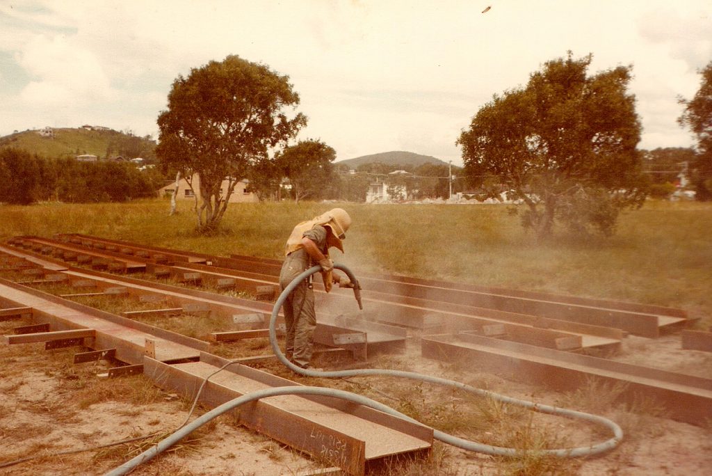
THE PHOTO accompanying this remembrance might seem to be a long way from the Coolum of today, but it was actually taken right in the centre of our town, just over forty years ago! It tells much about the Coolum of that time. Toboggan Hill – rising on the left of the picture is green and almost bare, with few houses on its slopes. Mount Coolum is virtually untouched, and the empty paddock in the foreground is getting a major building and that building was to be St. Peter’s Catholic Church, which has now been a feature of Coolum for forty years, since 1982 and is located at 28 Elizabeth St in Coolum.
The first documented Mass in Coolum was held on the evening of Sunday, February 5, 1978, at the Clansman Motel, where the Coolum Hotel now stands, just after Father Harry Bliss was appointed to the Stella Maris Parish. The need for a Catholic church in Coolum was made obvious on that evening when ninety people crowded into the motel for the service. Over the next few weeks, the Clansman Motel, the Anglican Church and the Uniting Church all made room for Catholic participants in a ‘Mission’. Following a large celebration at the Civic Centre on Easter Sunday 1978, that venue became the place of worship for members of Coolum’s Catholic community at regular 7 p.m. Sunday Eucharists.
In February 1979 the Stella Maris parish newsletter posted a message – “Wanted: A church at Coolum”, and the following week the first parish meeting was held, and a bank account opened at the National Bank at Coolum, with $2040 from donations in 1978 and $1000 from Stella Maris Parish funds. Later that year the parishioners began a steady stream of money-making activities which included cake stalls, fashion parades, cent auctions, and a range of other fundraisers.
Site work on St. Peter’s Church began in early 1982, and construction of the strikingly large, modern building began in March of that year. The building cost $162,000, which seems a minuscule amount compared to today’s enormous house prices of millions of dollars but was eight times the cost of a normal Coolum family home at that time. The splendid building was officially opened and blessed by Archbishop Rush on August 27, 1982, forty years ago this week.
St. Peter’s is a major institution in Coolum – not just for people of the Catholic faith, but for the general Coolum community. Annual ecumenical carol services have drawn people together at Christmas and charity groups of all persuasions have held fundraisers under its wide-spreading roof. St Peter’s Catholic church has been part of Coolum for forty years and it continues to be an important and inspiring part of our community.
Up, Up in the Air!
COOLUM has always been a favourite place for people to visit – with the glorious sun, surf and sand of Coolum’s pristine beaches, attractive park areas and coastal walks which provide wonderful recreational opportunities for visitors and residents of all ages, there are other attractions which have delighted many people over the last century. From late 1922, when buyers of house blocks at Coolum were wooed by advertisements describing “… hard and level sand – where later on the motor speedsters will score in a straight 5 to 10 mile run at 80 to 100 mph.” The excitement of car, motorcycle and horse racing on the beach drew people to visit our shores. In the 1930s keen visitors and locals could, for a small cost, ride horses and even camels along the beach.
For several decades after that first sale, young and old alike enjoyed “tobogganing” on the north-facing slope below today’s Low’s Lookout, sliding down the grass slopes of what was then called “Green Hill”, but soon became “Toboggan Hill” – a name which persisted for more than seventy years. The steep slope and shiny grass were a perfect base for speeding children and adults riding a range of devices from smart wooden speedsters to kitchen trays. Wooden fruit-packing cases and the unsophisticated fronds of the Archontophoenix palm which grew locally were also used to slide down the hill.
In the new millennium, however, sliding downhill on a palm frond is a long way from the wonderful pursuits available to those who live near, or visit Coolum Beach. In October 2000 the Coolum Kite Festival attracted some 12,000 people marvelling at huge kites of many shapes, By 2003 the crowd at the Coolum Kite Festival had swollen to 18,000, and the following year, when the festival was held in September, 30,000 people swarmed onto Coolum Beach to enjoy the colourful spectacle. Coolum Beach Lioness Club prepared and sold hundreds of serves of strawberries and cream from 2001, and the festival continued to be a great fundraiser for Coolum Lions and Lionesses until 2009. In later years, the Kite Festival moved closer to Brisbane and found a new home at Redcliffe.
Now, Coolum has a colourful new attraction, with the Ferris Wheel which has been erected in adjoining local parks – Norrie Job Park, and the Lions Park – situated just north of Coolum Caravan Park, and opposite the Coolum Hotel. Many local people have tested this experience already, marvelling at the amazing views to be seen from the big wheel, which is thirty-five metres in diameter. While my feet will remain on solid ground [my siblings say that I become giddy if I stand on a matchbox] many others will happily be Up, Up, in the Air!
A Royal Appointment
MANY of us recently viewed some of the celebrations commemorating Queen Elizabeth II’s seventieth jubilee. However, when I mentioned that Her Majesty had once visited Coolum, several people argued that she had done no such thing! Some long-term Coolum residents, especially those who had been pupils at Coolum State School in 1983, thought that I meant Prince Charles and Princess Diana, for whom they had waited along the school boundary for hours, only to have the royal couple speed past without even waving.
However, Queen Elizabeth II did visit Coolum – in March 2002 – and this visit became one of the most carefully protected occasions which Her Majesty ever experienced. Initially, the Queen had been expected to visit Queensland in October 2001, for the 17th Commonwealth Heads of Government Meeting (CHOGM) but unfortunately, the September 11, 2001, terrorist attacks on New York caused not only a postponement of the meeting but also a change of venue, from Brisbane to the Sunshine Coast. The CHOGM lasted from March 2 to March 5, 2002, and most of the leaders – who represented 51 Commonwealth countries – stayed at the Hyatt Regency resort at Coolum. However, the Queen and Prince Philip stayed at the Twin Waters resort at Mudjimba, where some meetings of officials also took place, travelling from one site to the other in a Rolls Royce, preceded by half a dozen motorcycle police officers.
Security was on the mind of everyone, following the tragedies in New York, and Australia went all-out to protect those who attended the meetings, to the extent that reporters dubbed the event “Fortress Coolum”! Three days before the CHOGM started FA-18 jets began patrols over the Sunshine Coast, armed with air-to-air and Sidewinder heat-seeking missiles, patrolling a 25-nautical-mile flight-exclusion zone. It was said that “some 2,400 military personnel” were “on the ground and in the air”, and that “alongside the army … some 4,000 state and federal police [were] deployed”, but for curious locals, the most obvious indication of security came from the bored-looking police officers, standing about five metres apart as they surrounded the Hyatt Regency grounds, day and night, throughout the CHOGM week.
On the opening day of the conference, Queen Elizabeth, dressed in a coral-pink outfit, was greeted at the intersection of David Low Way and Warran Road by ninety or a hundred Coolum area residents, dressed colourfully in ‘Coolum casual’ style. Two minutes, and she was gone, leaving us to watch that night’s television news … there she was, carefully coiffed, and we carefully listened as she stated “I am so pleased to be here in Coo-LUM” … no-one had briefed her on the correct way to pronounce “COOL-um” correctly!
The heart of Coolum
BETWEEN 1971 and 1976 the population of the Coolum area grew from 463 to 1183, and by the mid-1970s a range of new facilities, including the Civic Centre and the Fire Station, four churches, two caravan parks, a dozen ‘motels’ and many shops had shaped the Coolum Beach area we know today. However, three major facilities were missing – a high school, a police station, and an ambulance station.
At a public meeting in Coolum in June 1975, it was resolved that a recommendation should be made to the Nambour District Committee of the Q.A.T.B. that an ambulance sub-centre should be established on land already owned at Coolum. Two new committees – a Coolum Benefit Committee and a Ladies Committee, were formed, and between 1975 and 1977 they raised $11,000 towards an Ambulance Centre which was expected to serve the area for the next twenty years. The sub-centre would include a residential area upstairs for the Ambulance Officer, his wife and family, furnishings, equipment, and an ambulance as well.
On August 27, 1978, when the Coolum Ambulance sub-centre was officially opened by Sir Douglas Fraser, the president of the Queensland Ambulance Transport Brigade, it was announced that the total cost of the building and vehicles would be over $100,000. However, largely due to the efforts of the hard-working and charismatic Ambulance Officer, Stuart Sharp, organisations all over the greater Coolum area – the Lioness Club, the Boy Scouts, the soccer association, and housekeeping staff at the Hyatt Regency Coolum resort, rallied to help raise money for “their” ambulance station, and the Coolum Lions Club raised $25,000 for a much-needed defibrillator. For fourteen years of this time, Mr Sharp’s wife, Grace, and their children lived above the ambulance station, and she helped the “heart of Coolum” to become a valuable asset to the community.
Mr Sharp used to say that he “knew half the people in the greater Coolum area and the other half knew him” because of his wide-ranging activities! Coolum Lionesses assisted local doctors to run blood donation sessions in the ambulance station, surfers were treated after accidents in the surf, and Boy Scouts practised their bandaging on the popular Station Officer. Babies arrived into the world in the back of an ambulance, and bulging carpet snakes were rescued by ambulance staff – the Coolum Ambulance Station became the beating heart of Coolum in the late twentieth century. By 1992 the busy Ambulance Station was manned by eight officers. In 1999 Mr. Sharp was awarded an Australia Day Achievement Medal for his services, shortly before he retired. Through his efforts, the Coolum district’s ambulance centre had become the heart of Coolum. Today’s Ambulance Station which is now located on South Coolum Road has 17 officers.
Thank you ABC!

ALTHOUGH I, like many Sunshine Coast residents, was not born in this area, I grew up in a small country town where my father was a bank officer and was immersed in the history of that district from a very young age. I passed an indigenous ‘canoe tree’ at least twenty times a week, because I lived close enough to the school to be able to go home for lunch every day, and many of our weekend activities involved visiting local farms, including the historic homestead whose name now represents that region.
A common denominator in our district was the “wireless”, which was in almost every home. Every morning before I was old enough to start school, we would listen to the ABC program “Kindergarten of the Air”, and at lunchtime, we would hear the news and my mother’s favourite serial, “Blue Hills” as well as the ‘rainfall and river heights’. After school we would listen to “The Argonauts”, and on Sunday evenings we would sing along with a hymn program. At school, we would sing with the ABC radio, knowing that other students across Australia were learning the same songs – my husband used to reminisce that he and another boy were sent out to weed the garden at Coolum State School at that time because they sang so badly!
Although very young, I clearly remember the day we heard that King George VI had died [when “The Dead March from Saul” played mournfully on the radio all day], and the wonderful day the following year when we heard on the ABC that Queen Elizabeth was crowned and that Sir Edmund Hillary had conquered Mount Everest. I will never forget being allowed to stay up that week to hear Australia playing for the Ashes in England – through the very crackly ABC commentary!
Despite the fact that Nambour had had its own electricity scheme since the early 1930s, which “was so successful that it attracted a takeover bid from the Brisbane-based City Electric Light Company” in 1935 and that Yandina “had electricity” during World War 2, there was still no electricity in the Coolum area until 1956. My father-in-law, at Coolum Creek, would carefully listen to the ABC radio at lunchtime to see what his pineapples, beans, tomatoes and other goods, sent to markets in Brisbane, Sydney and Melbourne, had sold for. He never drove a car but had two car batteries – one was used at home to listen to the ABC, while the other was sent to Yandina to be charged and returned on Coulsen’s boat.
The ABC, was their link to the world and was important to so many people – it deserves our grateful thanks as it celebrates its 90th birthday.
Fishy business!
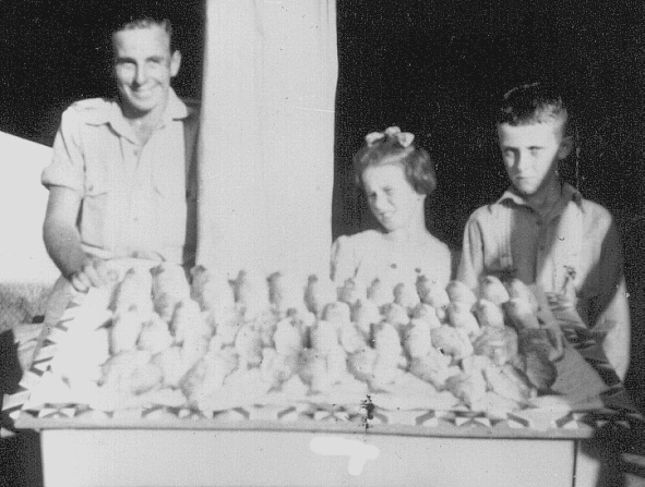
WITH MY mind still on the joys of fishing in early Coolum (mentioned in my last column), I was greatly surprised when a tiny booklet, on the same topic, literally fell into my lap as I sorted my files this week.
The 23-page booklet, 15 centimetres high and 10 centimetres wide, was published by the Yandina Amateur Fishermen’s Club [Y.A.F.C.] in 1950. It contained details of by-laws, meetings and membership. Five shillings for ‘active male members’ [equivalent to $9 today] and two shillings and sixpence [$4.50] for ‘active lady members’, and ‘juveniles’ per year. The book also states that visitors from distant localities and kindred societies visiting Yandina could become honorary members for up to three months.
The objects of the club were, “the protection, propagation and acclimatisation of fish, the improvement of the method of transit and the distribution of supplies, the better demonstration of the economic value of the fishes inhabiting our waters, the promotion of good fellowship amongst amateur fishermen, and the advancement of the sport of fishing.”
Each competitor might fish “from a boat, wharf, bridge, shore or any other support unless otherwise specified by special conditions” and each fish had to “be of or exceed the respective weight or length … prescribed by the Club.” Competitors in “land fishing” had to remain five yards [roughly five metres] apart, and boats could not “approach within twenty yards of each other except by mutual consent”. Anglers could not use more than two lines, with no more than two hooks on each.
Was it worth it? Well – in 1920 Stan Turton reported that, “The fish were biting well like they were on New Year’s Day, and when the womenfolk and Dad came down for a swim, I had bagged 42. However, I kept on until I threw my sinker in, and taking my haul to the camp donned my togs and joined the others… By this time Phill and Bill Worthy had returned with a haul of 54, so the total for the day’s catch was 117.” At breakfast the next day, the group “polished off the remainder of the fish” and then went fishing again, commenting – “The fish were biting well again and by dinner time we had bagged 90.” Many local people, particularly on Marcoola Beach, have seen the winter “mullet run”, but the hauls listed above were in mid-summer!
Even in the 1940s and 1950s, fishing from the shore, and in Coolum Creek [in today’s West Coolum area] the fishing was excellent, The Windolf family, who lived near to the Coolum Creek wharf, often made catches of 30 or more fish in a day at this time. How things have changed!
A dry argument …

HAVE YOU ever stopped to think how many places there are in the Coolum area, let alone in our surrounding districts, which sell alcoholic drinks? I’m sure that any attempt to list them all would be a lengthy one, and many arguments would ensue, no doubt. Another subject of argument might be to consider the decade [or even a more precise date] when the service of alcohol in the district became legal – hopefully someone might shout the winner a drink!
Actually, the “Island Surrounded by Land“ that was Coolum was officially a very dry “island”, and the first liquor licence in the district was not issued until November 1963, when the Coolum Bowls Club was opened. The Bowls Club building was a second-hand one – it had been the old Life Saving Clubhouse, purchased for 300 pounds [just under $5,000 in today’s money].
Of course, there are ways around most things in life, and this was the case for some people requiring an alcoholic drink. Residents and some visitors to Coolum who were ‘in the know’ – found ways to service those who were several hours travel from legitimate licensed premises and unable to purchase alcoholic drinks elsewhere.
Arthur Mulley lived a short distance from the very respectable, very tidy Bob Tickle, but the two men were very, very different. Arthur was known as the “Bait King” because he always had a supply of bait ready to sell to fishermen, but his not-so-kingly ‘mansion’, built on the lee side of the sand dune on the Camping Reserve, was totally ramshackle, constructed from a couple of sheets of rusty iron, a few boards and some old rotten tarpaulin, with heaps of ‘found objects’ surrounding it. Despite its derelict aspect, though, Arthur’s shack attracted a steady stream of visitors, both local and from further away.
One reason for Arthur’s popularity was that he owned a battery-operated radio – a rare commodity in pre-electrified Coolum – and he was willing to share it with those who were keen to listen to a report of Bradman batting, or other sporting details. However, in those days when Coolum had no licensed premises, and no police presence, he was also known for supplying ‘sly grog’ to fishermen from as far away as Yandina, and there are still men along the Maroochy River, and in surrounding districts, who remember the good times they had in Arthur Mulley’s ramshackle hut – warmed by fishermen’s tales and a considerable supply of rum, supplied at a cost, but without regard to distant policing. Arthur Mulley died in 1955, and his hut was knocked down soon afterwards. However, the ‘service’ he provided to local people and visitors, still brings a smile to elderly faces in this district.
Dating your location points
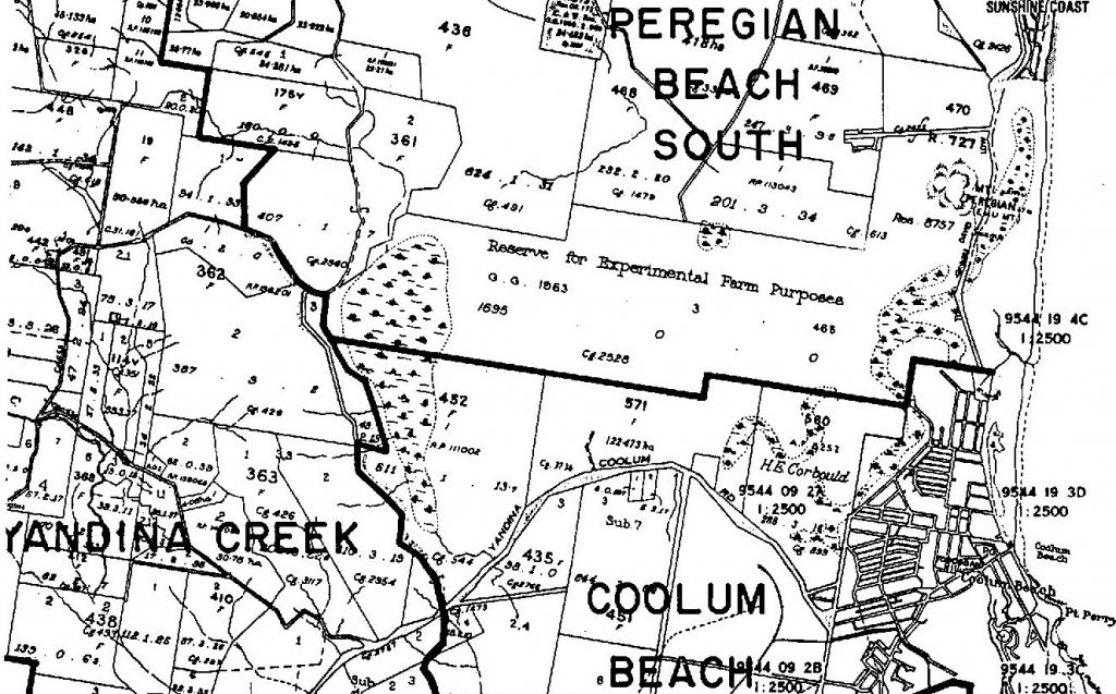
Dating your location points
AS I STARTED to write this article, I had a confused phone call from a friend who stated – “Near the Post Office” he said, trying to describe a building location. I suggested the Post Office which stood in Beach Road until January 1986, or the one in Wright Place on the William Street – David Low Way corner, whereas he was talking of the Birtwill Street office.
In our rapidly growing area, it is interesting to judge how long people have lived here by descriptions such as this. A ‘Coolum school’ might mean the Provisional School opened in 1917, the Coolum State School which stood at the corner of Warrack Street from 1930 to 1955, today’s Coolum State School on School Road, or Coolum High School in Havana Road.
One phrase which helps to judge when people became members of the Coolum ‘family’ is the term ‘D.P.I’ … if you are puzzled by this term, this article might help to explain why.
Seventy years ago, on March 31, 1952, the Queensland Minister for Agriculture and Stock wrote to Mr David Low, the Member for Cooroora, the local member for the Coolum and Nambour areas, to tell him that an area of 1,930 acres [just over 781 hectares] had been “set aside as a reserve for experimental farm purposes, in Portions 610 and 470 in the Parish of Maroochy … situated close to Coolum Beach”. The letter explained that “departmental officers (had) recently been devoting some considerable time to an examination of the potential uses to which the many thousands of acres of ‘Wallum’ soils extending along the Queensland coast might be put”.
The “Reserve for Experimental Farm Purposes” formed a reverse “L” shaped area, stretching up the coast from today’s Stumers Creek bridge to today’s Emu Mountain Road and – on the southern side – out towards Yandina Creek. It was managed for many years by Coolum resident, Cliff Wright, the Department of Primary Industries (D.P.I.) station had instituted great advances in the treatment of coastal Queensland soils. However, by the mid-1970s, it had completed most of its research work, coincidentally at a time when the population of Coolum had grown to such an extent that other services were becoming needed. In 1975 a request was made for a police station, and in 1977 a High School was requested. Both were built on D.P.I. land – the Police Station in 1983 (later to be moved to central Coolum and later to South Coolum Road), and the High School in 1985.
The term “out at the D.P.I.” is still heard in Coolum – mainly by older residents. If you hear it used, maybe you can locate this great area!
Electoral roll gold

AS WE approach the coming Federal election, I have been lucky enough to come across a paper listing all the citizens from the Coolum area who were eligible to vote on the Cooroora Electoral Roll in 1953 – 69 years ago! Instead of being just a boring list of names, this is “Gold” in that it tells us so much about our town, and the people in it at that time.
At that time adulthood and voting age was 21 years of age – and this encompassed a total of 107 citizens in the area roughly between Sunshine Beach and the Maroochy River. It was a male-dominated population with only 46 women. All these women were either housewives, that is, married women, or engaged in domestic duties, which meant that they worked only at home and were unmarried. No woman was registered as being employed outside of the home, although it is certain that many of them worked hard on family farms.
The 61 men shared a wide range of employment. Farmers accounted for 28 of the men – most of them were just registered as farmer, but there was also a cane farmer, a banana farmer, a fruit grower, a canecutter and a dairyman. These included well-known names as Cecil Apps, Merv Doyle, Tom and Bill Hart, Birt Hewitt, George Lambert, both Jack Morgans (father and son), Martin Oosthuizen, Don and Leicester Peterie, Vic Sakrzewski, Jack and David Smith, Verner Yabsley and my father-in-law Alex Windolf.
Eleven of the men registered ‘none’ in the employment listings and these men were presumably retired and possibly on a pension, although the wives of those who were married were still described as a housewife. Amongst these names was Tyrell Labatt, who was well-known as an artist. There were also ten men who listed their occupation as labourer and these included Vic Barrett, Fred Carter, Arthur Mulley, Herbert and Albert Wintzloff and George Wruck.
The other 14 men had a wide range of occupations, and these give a good picture of the services needed to keep a small town running. Arthur Anderson was a truck driver, Thomas Dutton was a fitter, George Armstrong and Otto Wruck were carpenters and John Bauer was a traveller – presumably a commercial traveller. Cyril Shooter and Les Stark were bus drivers – running the service to and from Nambour and two very important people in the town were Alfred Dahl the schoolmaster and Bill Wallace, the postmaster. Unusually, there was also a soldier by the name of Arthur Bassham, but unfortunately, we do not know how or why he made part of the local population.
All of these people helped shape our town – I can’t help but wonder what ‘gold’ today’s electoral records might reveal.
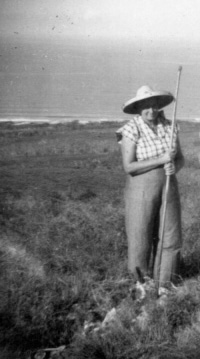
WW2 memories – from our own turf
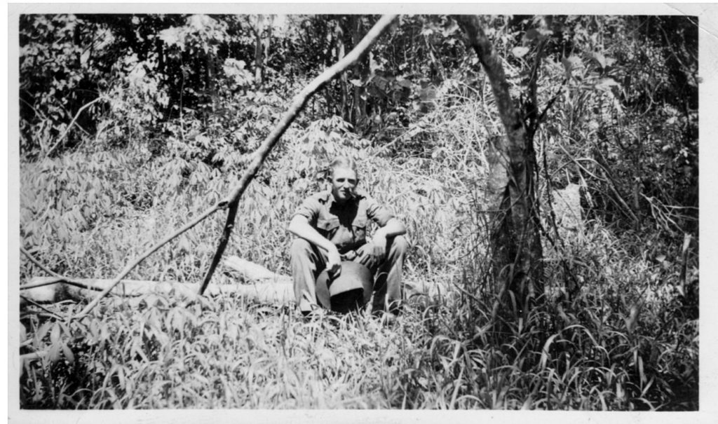
ANZAC Day is made for memories and reminiscing – usually thinking of war stories from far away. However, our part of the Sunshine Coast – above the ‘Brisbane Line’, played an important part in keeping Australia safe, and there are many stories that are worthwhile remembering.
Early in November 1939, the Coolum Progress Association had complained that “… the Military Camp had picketed their horses to the tree guards …and trenches had been dug on the frontage and not filled in.” Most likely the Military Camp was from the part-time militia unit in Yandina, which had had to build a new drill hall in 1939 to cope with a steadily increasing stream of volunteers. By December 1939 the CWA ladies had formed a committee for the Australian Comforts Fund, making cakes, socks, balaclavas, jumpers and gloves for soldiers in Europe and were also making nets some seven metres square, woven from greasy twine. Mrs Coulsen of Yandina, whose husband and son ran the boat to Coolum Wharf, made 31 of these in one year! The Volunteer Defence Corps, whose members recorded passing ships, and patrolled Coolum swamps – keeping the area safe from invasion – worked throughout the war from the Grant family’s holiday home overlooking Point Perry.
Coolum provided 28 local people [including seven women] to the armed services during World War 2. However, thousands more troops – temporarily based in the Yandina district – practised their skills in the area between the railway line and the ocean, climbing the hills and cliffs, running on the beach and landing from flat-bottomed boats, while adapting to tropical conditions. A thousand men of the 2/14th Battalion trained in the Mount Ninderry area before heading for the vicissitudes of the Kokoda Track, and the 2/7th Independent Company of commandoes [who became the first Australian troops to fly to war when they flew north from Townsville to Port Moresby in October 1942] also trained in this area.
As a child in Victoria, I loved my father’s war stories – although he would only tell us of happy times shared with his unit. One favourite story involved he and his mate being sent uphill because their drinking water had stopped flowing, only to find that a cow had died in the creek, damming it, so that all their water was flavoured by dead cow … we would often beg him to tell it. My Dad died seven years before I moved to Coolum, and some years afterwards his mate Jack recounted the story to me. You can imagine my surprise when, the next week, Dulcie Fink of Maroochy River told me the story of ‘Frank and Jack’, not knowing she was talking of my Dad!
Our ‘godfather’ of swimming and surfing
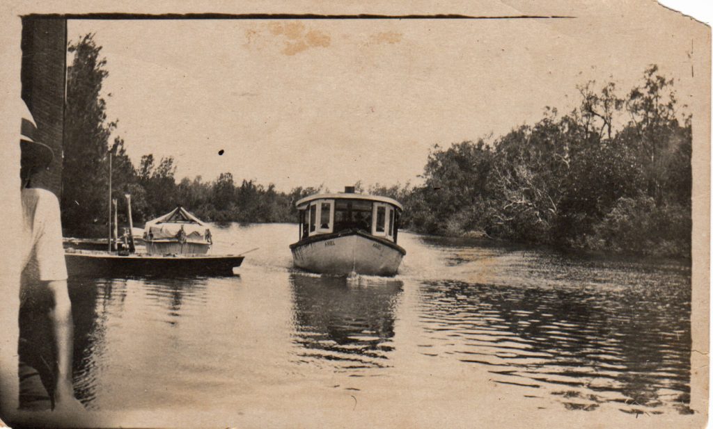
THERE must be thousands of people who have, over the years, connected the words ‘Easter’ and ‘Coolum’ when considering a beach holiday, and this year will be no exception. Most of these people though would be surprised to hear that the surf beach at Coolum was often not the first choice for a swim in the early days of settlement in the area, with many choosing to swim at Coolum Creek, in the area now known as West Coolum rather than risking the waves at Coolum Beach. Bodysurfing at Coolum was first reported in the Nambour Chronicle from October 1915.
Few people today know of Frank Venning, who lived at Maroochy River at that time. However, he could truly be called the ‘godfather’ of swimming and surfing in our region. Frank Osmond Venning was born in London in 1876 and won numerous swimming and diving competitions there. He married in 1899 and travelled to Western Australia for business reasons, but “went broke” and returned to England. In 1908, encouraged at the London Olympic Games by Sir Frank Beaurepaire, he returned to Australia with his family and became manager of the Fortitude Valley baths and secretary of the Queensland Royal Life Saving Society. In 1912, after three young men drowned at Southport, he began training teams in the use of a reel, line and belt for saving lives.
In 1915 Frank Venning moved his family to Maroochy River, where he became notable for his forward-thinking which improved life in the district. One day, when he was travelling in Mr Coulson’s boat to Maroochydore, he met two young boys at the Coolum Creek wharf, and asked why they weren’t at school … when they told him that there was no school in the area, he organised a meeting which led to Coolum’s first educational institution. In March 1917 he organised “a large concourse of people” – who arrived in motorboats from up and down the river – to the first swimming event in Coolum. It was recorded that the Coolum team lost to Bli Bli “by a foot” [30 centimetres]! Frank’s daughter Elsie Venning went on to become a top Queensland swimmer.
In 1918 Frank Venning approached Jack Morgan [senior] to “do something about Life Saving” at Coolum Beach. Jack, who had trained in Sydney surf, was appointed as Lifeguard by the Maroochy Shire Council for eight shillings a day, working from 6am to 6pm.
In 1930 Frank Venning helped found the Queensland Royal Surf Life Saving Association, became a life member, and was awarded an M.B.E. He lived until he was 92, still working for life-Saving. Remember him when you go to the beach this Easter.
History and a pint of petrol
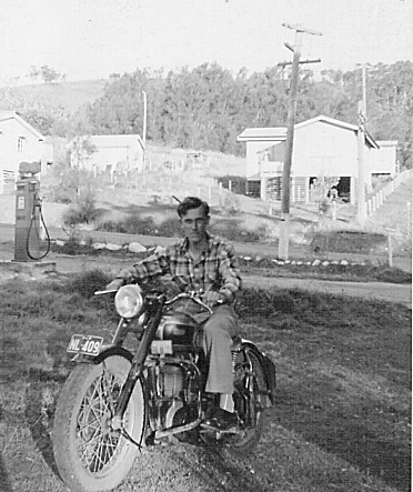
RECORDING personal and local histories are often a thing we plan to do “someday”, but often that day never comes. Here in Coolum, we have been lucky in that many of our elders have shared their knowledge of our history with words, newspaper clippings and photographs … but collecting much of our early history was facilitated through a local garage and service station.
In 1954 Theo Chapman had started a small garage enterprise at the southern corner of Beach Road and the Esplanade, but four years later, in 1958, John Murphy opened a more comprehensive garage on the site of today’s BP garage – coincidentally, on the site of the original Perry-Keene home and guesthouse. “Murphy’s Garage” became a repair centre for local Coolum farmers, and visitors to the town for some 25 years – servicing cars, utilities and farm vehicles and providing fitting and turning services and heavy welding.
John Murphy married Caryll Windolf, and when Caryll’s brother John [who later became my husband] returned from stints in the Australian Navy and at Mawson Station in Antarctica, followed by travels in South America and Britain, he helped in the business, which had grown rapidly since his departure. Between 1961 and 1981, the population of the Coolum area had grown from 190 to 2954, an increase of almost 1500 per cent, so there were many notable changes in the area. The impact on Coolum’s earlier population must have been startling, and John Windolf found that the local farmers he had known as a schoolboy were now senior citizens, somewhat bemused at the changes in their home area.
One familiar refuge for these aging men was “Murphy’s Garage”, where they would come to buy, ‘a pint of petrol, please’ for their lawnmower, then sit and chat with their friends about earlier times. John Windolf realised that their tales of early Coolum would disappear, as they frequently commented that “my kids aren’t interested in anything old”. Consequently, he began to write down their stories, with permission, and they responded by bringing him photographs, newspaper clippings, scraps of faded paper, and many, many memories – a cornucopia of Coolum and district history. These were carefully stored in a series of second-hand apple boxes – a real collection of treasures!
I came to Coolum as the first Teacher-Librarian at Coolum High School, in 1985, read a paper discussing the 1862 wrecking of the ’Kirkdale’, and asked where I could get a copy for the school. Four months later I married John Windolf, and after I retired, I wrote “An Island Surrounded by Land” in 2004. John’s collection started with “a pint of petrol please” and became the basis of a wealth of our local history.
Relics in the hinterland
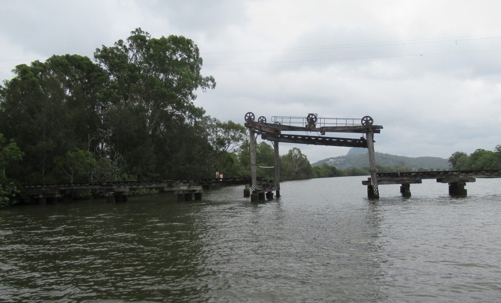
Most Coolum and North Shore residents live within five km of the coast, and it is fair to say that many residents are not familiar with the hinterland of our area. The hinterland region has many historical sites such as the Tramway Lift Bridge at Store Road Maroochy River, which is just off the Coolum Yandina road. There were two Lift Bridges in the [Nambour] Moreton Mill network initially, at Store Road and Petrie Creek, but the Petrie Creek Bridge closed many years ago.
Most cane trams to and from Moreton Mill in Nambour ran on temporary tracks, but the Store Road Lift Bridge, which was completed in August 1921, was necessarily much more permanent. A permanent low-level cane tram line would have blocked river traffic along the Maroochy River between Nambour and/or Coolum Creek and Maroochydore, so a bridge with a movable span between two towers was built. The span, lifted by a system of cable, pulleys and counterweights, could be raised vertically to a height of nearly eight metres within the framework – operated by a man winding a hand-operated winch, and this allowed boats to travel up and down the river, it could then be lowered so that a cane-tram or a tram-load of passengers, could safely travel across.
Until 1927, the road to Coolum was of such poor quality – being basically just formed by tea-tree trunks laid side by side across a ground-level track to form a ‘corduroy road’ – the cane trams which crossed the Lift Bridge became a necessity for transport to and from Coolum. Initially, the route was so popular that more than 1000 people were estimated to have travelled by tram between Nambour and Coolum in December 1922/January 1923, but as time went on, and road travel became easier, fewer and fewer people travelled on the cane trams and that passenger service ceased in 1935. However, the Store Road Lift Bridge remained in use for cane transport into this century, until the Moreton Mill closed in December 2003.
Since that time, the Lift Bridge has been used in a range of ways such as being loved by fishermen and as a base for diving into the Maroochy River. It has been photographed by people in boats, painted by artists onshore, and it has been a destination for tourist boats from Maroochydore. It has been loved by many, including Coolum resident Andrew Palser, who valiantly fought to restore the bridge until his death in 2021. The lift section was removed to a council storage in 2020 and now rests in Caboolture.
Sadly, the recent floods in the area may have marked the end for the Lift Bridge, with even more parts being washed downriver. Is this the end for this part of our history? I hope not!
Water, water everywhere!
Recent persistent rainfall and floods sparked many comments, particularly from those who are relatively new to ”An Island surrounded by Land”, the book of Coolum history which I wrote nearly twenty years ago, about this lovely township surrounded by multiple water bodies such as the Pacific Ocean, Coolum Creek and the Maroochy River, and by miles of boggy swamps. There are many stories of wet years when it was almost impossible to get to Coolum other than by river launch, or from Yandina on horseback or the “corduroy road” of felled tea trees.
The 1950s were a very wet period, with the only road to Coolum being so bad that Brisbane newspapers reported that motorists had to be pulled out of the bogs and no warning notices were posted to save them from being trapped in a danger area covered with water, and not barricaded. The late 1980s and early 1990s were also notable for wet weather and flooded streets, but 1992 was a truly memorable year. Back then – thirty years to the day before our most recent wet-weather episode, many residents of central Coolum woke to find that their homes had been silently inundated during the night – in some cases by water so deep that it was lapping at their mattresses!
You can imagine their surprise, panic, and horror – and the fear that ensued for months and years afterwards. We had just flown overseas, and our house sitters were woken at 2am by someone banging on the front door and then stepped into 30 centimetres of cold, flowing water. Every carpet, cupboard, wardrobe had to be replaced, wallpaper peeled off walls, chipboard swelled to huge proportions – everything was a disaster – but repairable.
Naturally, Coolum residents wanted answers! Initially, heavy rain on the Blackall Ranges had flooded down the Maroochy River to the coastal plain, where it was met by a ‘King Tide’. However, rain fell here on the coastal plain as well – the “Jamaica” sugar plantation on the northwest corner of today’s Peregian Springs received a metre of rain in one day! That water followed its usual course – southwards, along a route west of today’s industrial estate, towards Coolum Creek – but was thwarted because no more water could fit into Coolum Creek or into the Maroochy River. The only way to go was eastwards into Coolum, inundating dozens of homes.
Why do I still live in that house? Well, the Commonwealth Government paid several million dollars for a protective bund wall between Stumers Creek drain and the National Park, and the Sunshine Motorway formed another protective barrier. Previous Councils have improved drains and roads. With 677mm of rain this month, I had only 25 centimetres of groundwater – I feel safe!
Hooray for heritage heroes!
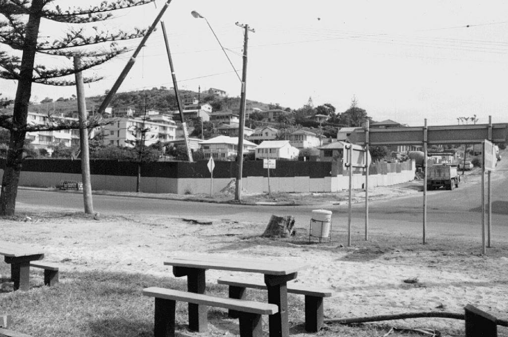
I wonder if other areas have had to fight as much to keep the heritage of pristine environment as the Coolum and North Shore. We all know of the superb efforts, which succeeded recently, but our heroes have been fighting for more than 65 years.
In February 1956 the Coolum Progress Association was intensely concerned about a plan for our frontal dunes to be leased to sand-mining conglomerates. They organised a local petition and sent an urgent telegram to the Minister for Mines, supported by the ‘Save the Trees Campaign’ – Queensland’s first environmental action group. Our beaches were threatened for another ten years but were saved by a ban on sand-mining in July 1966.
Between 1961 and 1971 the resident population of the Coolum area grew from 190 to 463, and hundreds of people from outside the area bought land and started planning their houses – although resident population growth was limited by poor facilities. With roads, better communications and the supply of town water, the population of Coolum, Point Arkwright and Yaroomba almost trebled between 1971 and 1976. Between 1961 and 1981 the population grew from 190 to 2954. During the 1970s, all along the Sunshine Coast, people were concerned that beaches would be striped by ugly shadows from high-rise buildings and although initially, Coolum seemed isolated from that scourge, local people shared the fear that beach erosion, shadows and wind tunnels between tall buildings would ruin our ambience and heritage.
In March 1980 the Coolum Beach Progress & Ratepayers Association welcomed experts from Mooloolaba and later wrote to the State Ombudsman. Of the 65 applications for high rise buildings between Maroochydore and Coolum, sent to Maroochy Shire Council in 1980, only 23 were erected, and two of these began construction in 1982. Coolum Caprice went ahead, but the Clubb Coolum site remained a deep hole until 1990. Another resort – the ‘$25 million Cascade Gardens tourist resort’, (planned for the hill below the water towers) was passed for development in 1982 – split the community in two, with the Coolum Concerned Citizens Association voicing opposition, and Coolum and Yaroomba Ratepayers and Progress Associations receiving support from, “26 of the 30 shops along the waterfront”. Fortunately, a 1982 by-law then limited “permissible height of new buildings to six storeys”, and the proposal failed.
However, in January 1986, when the Maroochy Corporation proposed a ‘chairlift and tourist development’ on Mount Coolum, some 450 people filled the Coolum Civic Centre to protest, and the Save Mount Coolum Committee began a five-year battle which ended in the formation of Mt Coolum National Park.
Our recent ‘heritage heroes’, who have fought so hard against the Sekisui proposal, deserve huge congratulations – they continue a wonderful tradition!
Schools have changed!
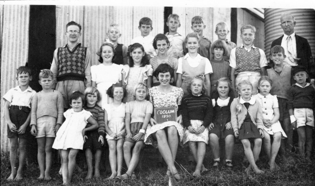
Today’s school students are experiencing changes unprecedented in their lifetime … and many of us wonder whether schools will ever be the same again. While thinking of the scale of change, my thoughts fly to “Little Johnny” and the changes he experienced as a pupil of Coolum State School in the 1940s and 1950s.
“Little Johnny” was nearly four-and-a-half when the school principal, Mr. Langusch, asked if he could start school in 1947, because the school, which was suffering from a lack of numbers caused by a post-war exodus from the Coolum area, would have to close for lack of pupils otherwise. His sister was seven years older and could accompany him each day for the first year. At that time the school was situated on the corner of South Coolum Road and Warrack Street, 4.5 kilometres from their home – a very long way for a four-year-old to walk twice a day! Mosquitoes were a constant nuisance on the lengthy journey around the western edge of Mount Coolum, and like children from other areas of the district, “Little Johnny” would carry an old jam tin with a wire handle, which contained burning dry cow manure to chase the mosquitoes away. Once at school, all the “smoky billies” would be centrally placed, to repel mosquitoes from the classroom. This continued after Mr Langusch was followed by Mr Dahl in October 1947, because it was the only way to protect the teacher and students from airborne pests!
There was little choice of where to sit, because all the desks were built to fit five children sitting in a row, and there were many arguments when the smaller ones wanted to sit closer to the blackboard than their older counterparts. Most schoolwork was carried out on “slates”, because paper, pencils and chalk were hard to come by, and students from that time still happily reminisce about searching for sea-urchin quills at Third Bay, because these made superb “slate pencils”. The school “Library” was an old wooden pineapple case nailed on the classroom wall!
Boys and girls went to school in bare feet, even in winter, and some of “Little Johnny’s” fellow pupils found that it was easier to walk to school rather than push a bike through mud and water in the wet season. At recess times, many of the students would ‘escape’ from the school, to hunt frogs and tadpoles … or even to catch snakes!
I married “Little Johnny” and heard these stories from him and his friends many times. He and some of his friends are no longer with us, but I can’t help wondering what tales today’s school kids will have to tell their children.
Yaroomba Street Names Revealed
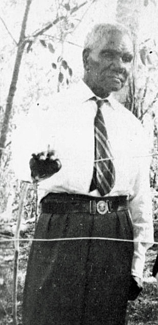
Last week I received a great gift – a copy of Stan Tutt’s book “Caboolture Country”, published in 1973, which a local resident had found in his private collection. This was important as, for the first time ever, I could put a face to the great man who named Yaroomba’s streets, just over sixty years ago.
Geeribauch [known as Willie McKenzie], who came from Kilcoy Station, provided great assistance to Dr. Fred Whitehouse, an academic at the University of Queensland, by repeatedly pronouncing each indigenous word until Dr. Whitehouse could write its closest sound value for posterity, as well as assisting Dr. L.P. Winterbotham, another University of Queensland academic. Dr. Whitehouse owned one of the first homes in Yaroomba, and brought Mr. McKenzie to at least one meeting of the Yaroomba Progress Association, held in the Brisbane suburb of St. Lucia, in 1961, where [according to the Nambour Chronicle] “a choice of between 20 and 30 words was made and studied by the members of the local progress association and … the street names were then altered to names from the local Yinneburra tribe”.
However, the local tribe for this district were/are the Gubbi Gubbi people, and Geeribauch was a Dungidau man from Kilcoy – a Jinibara [Yinneburra] man and the two groups spoke different languages. This led to confusion in the naming of some of our most prominent Yaroomba streets, because Dr. Whitehouse assumed that the names that Geeribauch had suggested were Gubbi Gubbi names. In the minutes of the May 1961 meeting of the Yaroomba Progress Association, [Yaroomba meaning “Surf beach”], these names were listed as … Yinneburra – “The tribe that lived here” … Goongilla – “Fresh water” … Yerranya – “Look at the flowers” … Warragah – “Surf” … Neurum – “Sunshine” … Waraan [now spelt Warren] – “Parrots” [This was followed by the explanation “… plenty along this road”] … Boward – “Low bush” … Wunnunga – “Good look-out” … and Birrahl – “Pleasant spot to rest in”. These minutes state that “All [of the names] are from the language of the local Yinneburra tribe of aboriginals.”
A street named Woolgin Esplanade [meaning “Ocean”] was planned at this time, but appears not to have been built, as well as streets proposed as “Gooyoom” – a camp, “Murra Murra” – someone else’s camp, “Baal” – salt water, “Moondoothin” – a sand dune, “Diyalli” – tailor fish, “Whawoong” – eugarie, “Yoorlo” – porpoise, “Dallagoor” – whale, “Yuangin” – dugong, “Meerbeer” – turtle, “Yerra” – flowers, “Yina” – a stream flowing into the sea, “Goooorbeen” – the north wind, “Nyoorin” – sun or sunlight, “Nyandair” – a swamp … and “Bingo” – a razor shell, all suggested by Dr. Whitehouse in 1960, from words shared from Geeribauch.
It would be great if local houses and/or units could share these names!
Christmas at Coolum
Our Australian population census is taken in winter, so we have no way of accurately recording how many people have enjoyed a Christmas at Coolum, but it must be a very large number by now. From 1888, Maroochydore was a favoured Christmas camping spot with many people from Brisbane – travelling by train to Nambour and by boat down the Maroochy River – returning annually to a Salvation Army site at Cotton Tree, but it was more difficult to get to Coolum.
We know that in 1915 a group of 40 or 50 people made a day trip from North Arm and Yandina to Coolum, where “a very pleasant day was spent in surfing etc.” and that during World War 1 a few houses were built along the Esplanade, including three cottages rented out cheaply to poor people by another Salvationist, from Gympie. However, it was not until Christmas 1918 that, “the beach … was thrown open to holiday campers” and Maroochy Shire Council appointed Jack Morgan senior as Coolum’s first lifeguard where he was paid eight shillings a day, from which he donated the first Life-Saving Reel in 1919, and the Coolum Life Saving Club was formed. In the 1930s the Coolum CWA Branch not only built a “Holiday Hut” to provide country people with seaside holidays but also erected a tent on the beach to shelter mothers and children from the sun and sold ‘billies’ of hot water to raise funds.
Since then the beach at Coolum has seen an absolute cornucopia of beach activities, at all times of the year, but particularly at Christmas. Beautiful girls in “beach pyjamas” posed outside the Life Savers Club in the 1920s, and “Belle of the Beach” competitions continued until the 1950s. Children took part in Christmas “Sand Garden” competitions in the 1940s and 1950s. Fashions changed … “neck to knees” costumes eventually became bikinis!
Horse races along the beach in the 1920s caused much excitement, where “the best place to watch them from was the surf, where the water was delightfully cool [while some people] had the pull over everybody else with tents to retire to from the sun.” Motorcyclists competed to be the fastest to ride from Coolum to Noosa Heads along the beach. Thrill-seekers now parachute to land on the sand.
Fishermen still wait until the afternoon to catch fish and dogs enjoy walking on sand and playing in the surf in limited areas, but we no longer see other animals on the beach … imagine sharing camel rides like those offered in the 1930s! Instead, we share the beach with hundreds of other humans, joyfully, as we celebrate Christmas – I hope your Christmas is full of joy, too!
Blasts from the past
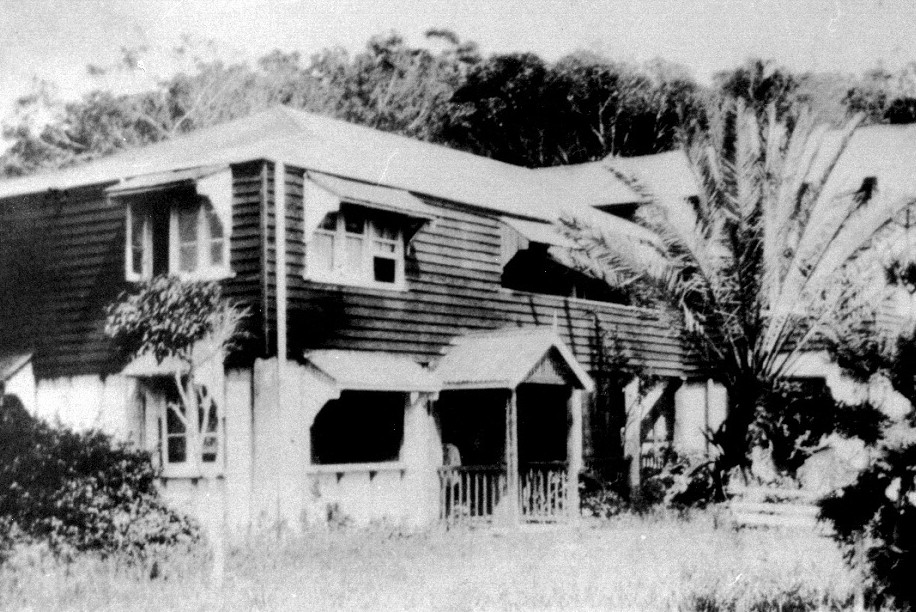
When seeking inspiration for this column, I found two adjoining articles from the Nambour Chronicle of February 7, 1919. I found it interesting to compare these two items to today’s ‘pandemic situation’ …
The first reads “… I feel sure that the Brisbane public have no idea that there is such an “earthly Paradise” within four or five hours journey of the Metropolis. We left Brisbane on the 8.10 train and arrived at Yandina at 11.30, took a vehicle to carry our luggage down to the motorboat wharf … [where we boarded] a comfortable launch, [then] started down the Maroochy River. Along both sides are pretty cane farms and cultivation areas – sugar, maize, oranges, bananas etc., with cosy homesteads, most of which are surrounded by flowers and ornamental shrubs. … The river wound in and out through many-coloured foliage and virgin tropical scrub, and in each reach new views of Mount Ninderry and other prominences were seen and admired … Mt. Coolum also seemed to show itself from many angles, as we got nearer to Coolum Creek where our launch left the main stream and proceeded to the landing place. The journey by water took one hour, and upon landing, we were met by Mr Perry-Keene who packed our bags into his buggy … [for the 4-kilometre drive] … to the Homestead. Words can hardly describe the beauty of the scenery, and when we arrived at the top of the last hill and saw the beautiful Green Hills – the snow-white sand of the beach, and the intense view of the mighty Pacific Ocean, we called upon our driver to stop in order that we might take it all in.”
The second item is headed “PUBLIC NOTICE … Pneumonic Influenza” [This was a term used for the widespread, and deadly “Spanish Flu”] … It reads “(1) The New South Wales Government Health Authorities recommend for protection against the germ, the use of solid inhalant from the formula of which Wawn’s Wonder-Balm is made, apply this up each nostril 3 or 4 times a day (price 2/- a tube) [equivalent to $5.00 today]. The balm is packed in collapsible tubes considerably lessening any danger of infection by contamination.” … The second section reads (2) New Zealand’s doctors recommended, and the Hospitals used Wawn’s Wonder-Wool during the recent Pneumonic Influenza epidemic there. It was pronounced invaluable, more particularly in preventing the influenza stage from developing into the pneumonic one. Be prepared! See today that a packet is in the house (price 2/6) [$6.00 today]. Ready on the instant, Wawn’s Wonder-Balm and Wawn’s Wonder-Wool are obtainable from all Chemists in the Commonwealth.
How different to things today … and how similar!
Trapped by history
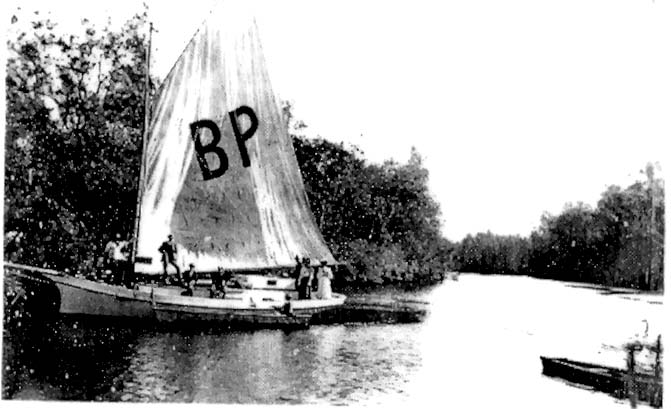
I have always been extremely careful when researching stories of Coolum history, but occasionally there is a ‘trap’ that leads to a mistake … and this week I came across one of these, in a newspaper article from 1903 … The story below concerns a journey made on horseback, buggy and boat from Buderim to “Coolam [sic] Mountain” on the King’s Birthday holiday in 1903, starting “at the early hour of 4 o’clock, when the moon was shining brightly” – and my mistake was that I had thought that this took place in May or June – as our monarch’s official celebrations have largely been since 1788 – but King Edward VII’s birthdays were celebrated in Australia close to his birthdate of November 9th. Here is the story, from the Nambour Chronicle of November 13, 1903, from the time that two boats [most likely quite large yachts] with twenty-six people on board, left Mr Guy’s home on Eudlo Creek …
“The morning was all that could be desired, the air being very bracing. Willing hands bent to the oars, and, though travelling against the tide, the foot of the mountain was reached at 8 am. The male party enjoyed a bath while the ladies prepared breakfast, which was heartily partaken of by all. Our leader then started for the top of the mountain, all following except three, who stayed with the provisions.
After walking about a mile and a half [2.4 km] through scrub and grassy country the real ascent began, and it was indeed labour for pleasure, three rests having to be taken ere the top was reached. It was a sight to see those picknickers assembled on the top, puffing and perspiring, with faces like the sun itself, which by this time had become very warm: but the panorama stretching away before us was indeed magnificent and well repaid our labours … Needless to say, we all enjoyed the beautiful breeze on the top, and also the views as seen through Mr. J. K. Burnett’s powerful glass.
… After satisfying ourselves with these glorious sights we prepared for the descent [which] proved very much easier than the ascent. The camp was soon reached [and] it did not take much to persuade us to dinner … At 2.30pm a start was made for home … with a good breeze blowing and some of the party providing singing. The oyster dredges were passed on the way down, and Mr Durbridge kindly gave us some of the bivalves, which were much appreciated with bread and butter on landing. The horses were duly caught and Buderum [sic] was reached at 6pm, a very enjoyable day having been spent.
What a day!
Shifting sands
3rd November 2021
As one of a multitude who are keen to protect our wonderful shoreline, I was recently surprised to hear someone suggesting that climate change was causing our beautiful sands to disappear forever. As a Coolum resident since 1985 I have seen many shifts in these sands, and historical records and memories from longer-term residents have shown me that there have been other geographical shifts over the last century.
The widely promoted advertisement for the initial Mt Coolum Beach land sale on Boxing Day 1922 promised many attractions, including a “Beach Race Course – hard and level sand – where later on all the motor speedsters will score in a straight 5 to 10 mile [8 to 16 kilometres] run at 80 to 100 m.p.h. [130 to 160 kilometres per hour]”. On 10 January 1923, the Nambour Chronicle recorded that “An item of considerable interest to those who love high speed in the motor world, was a run made by the Rev de Parelle on his 7-9 Indian motor bicycle from Green Hills to Noosa Point.” The Reverend was not the only speedster on this stretch, and I have heard anecdotes of others regularly making similar excursions, including one local man who was a championship rider – of course, at this time the drain that is now Stumers Creek was nowhere near as wide.
During the late 1940s to the early 1950s, the local girls’ netball team often traveled along the wide beach to games at Noosa on the back of a tractor, saving some 30+ kilometres each way … there were no health and safety regulations in those days! Closer to home, school picnics were held just south of the Lifesaver’s building, but the next small bay [opposite today’s Clubb Coolum] was out of bounds because the water was so deep that there was no sand in that area. Today that bay is a delightful sandy cove where families gather to play and relax together.
In the post-war era, when supplies of pens and pencils were short, Coolum students would walk to Third Bay to collect sea urchin quills, which replaced the ‘slate pencils’ used for their lessons. By the mid-80s, there were fewer sea urchins, but huge drifts of pumice stone, which had floated westward following volcanic eruptions in Tahiti.
When I first walked my dog on the beach near “Stumers” in the mid-80s the sand was so low that people could walk through ‘avenues’ of coffee-rock. I’m above average height, but the ‘avenues’ were taller than me. However, for the last thirty, and more years, there has been so much sand that we walk over the top of those rocks now.
No matter how our sands shift, we still love our superb beaches!
The Carnival continues
20th October 2021
Surely there can be few people in this world who can remember that their lives were enriched by a “Big Gorilla rip-off”! However, there are a number of people who fondly remember it, the “Pirate Pete fete”, and other such thrilling events at Coolum State School in the 1970s.
In 1971 (fifty years ago) Coolum State School had three teachers and 84 students. However, the rapid growth of the coastal strip from Peregian to Marcoola in the following six years meant that by 1977 there were 10 teachers and 202 students at the school. Schools are always provided with basic necessities, but in those days local people were expected to provide ‘extras’ which we would consider basic now. The Mother’s Club, which was established in 1970, originally provided Tuck Shop food once a month, then fortnightly and weekly – and eventually twice a week.
School fetes were small in the early days and fundraising for improvements not provided by the Education Department was difficult in an area that was far from affluent. Many different activities were tried, with varying success. One year a turkey was donated, but by the morning of the fete very few tickets had been purchased. To increase sales, Les Morgan drove around town with some ticket-sellers holding the turkey in a crab pot in the back of his ute. It was reported that the winner was horrified at winning a live bird but, it was said, “It was the only way we could keep things fresh in those days”!
On the fete day everybody pitched in to help, Jim Barns used to bring his tractor for rides, and Cliff Wright, the chairman of the P&C, used to bring his horse … one year, the horse disappeared when its owner went for a cool drink – a frantic car chase found one of the boys riding it, way up the road!
Fundraising by the Coolum State School P&C raised $685.00 in 1971, but by 1976 the P&C income had increased to $7,123.00. In 1975, the “Big Gorilla Rip-off” fete was a huge success – so much so that the funds, with the aid of a government subsidy, were enough to build a Tuck Shop for the school – a modern, attractive area under the main brick building which cost $2,400,00. In 1976 the “Pirate Pete Fete” raised enough money to build an Adventure Playground, constructed mainly from local timbers, at a total cost of $2,500.00.
These, and subsequent fundraisers, built Coolum State School’s complex to what we see today. The brilliant annual “Coolum Carnivals” which so many people enjoy, and which help school finances so much, continue … why not join the fun this week?
Creek-ing confusion
6th October 2021
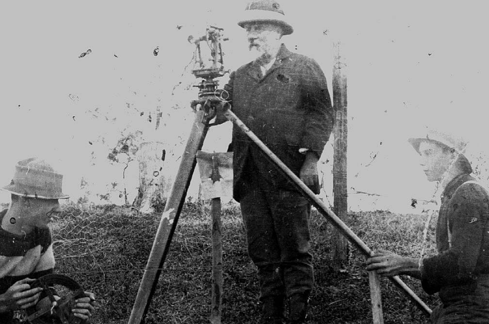
I have recently been asked to clear up confusion between Stumers Creek and Coolum Creek. This problem arises, I believe, because Stumers Creek enters the ocean at Coolum Beach … but Coolum Creek is quite some distance inland! Many residents and visitors have never seen Coolum Creek, despite it once being the main entry to this area.
Coolum Creek can be reached by two ways. One involves travelling from Bli Bli or Dunethin Rock by boat, then branching northwards at the entrance into the Coolum Creek Conservation Area. By road, you follow the southern side of Mount Coolum along Suncoast Beach Drive, Mountain View Drive, and West Coolum Road, over the motorway and left along a dirt road to Coolum Creek, where there is a boat launching area beloved by fishermen.
As early as some 140 years ago, when it took hours to travel from Yandina to Coolum, Coolum Creek wharf was the major entrance and exit to and from Coolum. Timber from the Coolum hills was rafted to the port of Maroochydore and, later to the railway at Yandina. Later, fruit and vegetables were carried to markets in Brisbane, Sydney and Melbourne, mail, machine parts, food, parcels, furniture, and many other items were delivered to the Coolum Creek wharf by the boats “Kate” and “Ariel” run by the Coulson family between Yandina and Maroochydore. Coolum could not have developed without Coolum Creek as its major link with the outside world.
Stumers Creek is crossed by a bridge at the northern entrance to Coolum. Wilhelm Carl Stumer [known as Carl] took up 16 hectares comprising today’s First, Second and Third Avenues in February 1906, and the land was worked by his eldest daughter Rebecca Berry and her husband, Edwin Berry for a year. In 1907 Carl moved to Coolum with 17-year-old Fred and Fred’s brother August, and during the next eight years cut the property up into allotments, which were mainly taken up by people around North Arm, where the Stumer family had previously lived. In his early twenties, ‘Young Fred’ secured a job with Surveyor Robert Abbott, as a ‘chainman’, measuring and mapping the land on which today’s Coolum was to be built. Surveyor Abbott was so impressed by his keen employee that he named the creek ‘Stumers Creek’ after him.
Originally, Stumers Creek drained waters from the south side of Mount Emu, and a small creek still runs there. However, today’s ‘Stumers Creek’, which runs around central Coolum and now separates the National Park from the residential area, was dug by local farmers in much later times for drainage. Most of us know it, however for the beautiful entrance to the ocean, which we all love!
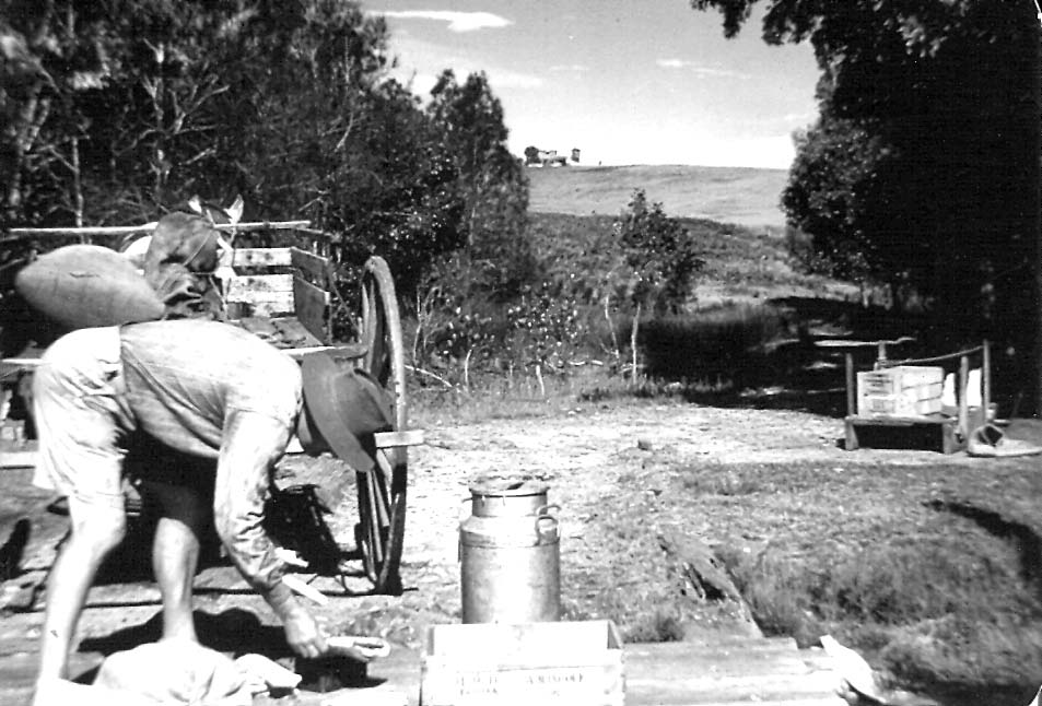
Tales out of school
22nd September 2021
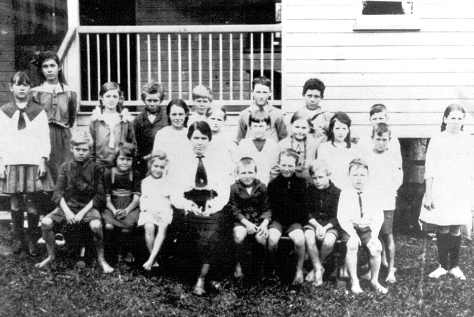
With Coolum and North Shore school students enjoying a vacation this week, this seems an appropriate time to share some stories from the past – from the Coolum Provisional School which was part of the Coolum School of Arts [which stood near the corner of today’s South Coolum Road and Toolga Street], and later from Coolum State School, which stood at the corner of South Coolum Road and Warrack Street. There was always only one teacher at a time for all the students from Grades 1 to 8, and there were 11 Principals and two short-term Acting Principals in that time.
The first teacher was Miss Ellen Chapman, who welcomed twelve pupils on the first day – April 2, 1917 – 18 pupils by the end of that year, and eventually 42 pupils between the first class and sixth class, all in one room, with one teacher. Miss Chapman was reportedly surprised by the number of wallabies, which hopped through the school ground, and there were stories of her students playing “follow the leader” over the top of the lantana bushes surrounding the school – ripping their trousers and replacing the stitching with long thorns from the school ground. Most of her pupils had never been to school before, and once a “big boy” grabbed the cane, which was used for punishment, broke it in half, and then left school – through the window! One wet morning, the boys plastered clay on the fence, which Miss Chapman climbed through – no one, would own up, so every pupil was kept in at lunchtime by their very muddy teacher.
When a travelling photographer visited, Miss Chapman lined up 23 pupils for an official photograph. Jack Morgan junior told us that just as the photographer went to take his one-and-only picture, one small boy ‘broke wind’ noisily – and the official photo featured the girl who stepped away from the smell!
Miss Jack came in 1926 when farms were being developed. At cane-cutting time the number of ‘students’ could double, because all the children, even toddlers, would come to school while their parents worked on the farms.
In the 1940s, Mr Languish once travelled back from Maryborough on a crowded troop train, then walked from Yandina to the school, arriving just in time for class. At lunchtime, he was so tired that he fell asleep, and was woken mid-afternoon by an irate farmer because the students were playing ‘paper-chase’ through nearby cane, knocking it down.
School supplies were in short supply in the 1950s, so students would search Coolum beaches for sea-urchin quills, to replace scarce ‘slate pencils’ … how different from todays’ technological world! I wonder … what tales will today’s students tell in the future?
Toboggan Hill – today’s modern mystery
8th September 2021
If there is any divide between “newbies” and “old-timers” in Coolum, then that divide is represented in the area known as Toboggan Hill, with “old-timers” knowing where Toboggan Hill is, and why it was called by that name … and “newbies” being puzzled by that term. Fortunately, those who know the answer to the mystery are so keen to share their knowledge that it is easy to slide from one group to another, so keep reading.
Toboggan Hill is hard to see today, as it is largely covered in new homes, but if you stand at the traffic lights beside the Surf Club and look southwest, you can still see the slope rising above Beach Road. If you are driving, then you can approach the lookout at the top of “the Toboggan” via Scrub Road, turning right at the top into Grandview Drive – once you get to the car park, you, too, can imagine the thrill of riding a toboggan down the slope in front of you.
The first official mention of “THE THRILLING NATURAL TOBOGGAN” [which was to be “reserved for the residents”] appeared in November 1922, in an advertisement for a Land Sale to be held on Boxing Day 1922. Although a toboggan is defined as “an object for sitting on and sliding over snow and ice”, Toboggan Hill sported a huge range of craft, which were used to carry people of all ages down the grassy slope of the hill. Local historian Fred Fink, who ‘rode the toboggan’ at the second Coolum Land Sale in 1923 could still clearly remember the thrill of that first ride some 75 years later.
One wonders how many tin trays disappeared from the homes of young Coolum residents or visitors, and wooden fruit-packing cases became popular toboggans. Excellent toboggan slides could be made from sheathing fronds of the Archontophoenix palm which was common in the district, and other enthusiastic locals built single, double, and treble seater sleds that accommodated groups of shrieking friends. In 1923, even the Governor of Queensland, Sir Matthew Nathan, ascended Toboggan Hill, in a daring journey up the track-less hill in a brand-new Special Six Studebaker car driven by a Mr Thornton, along with two ladies from Nambour, and two other men … it was recorded, though, that once they reached the top, the ladies got out and walked back down Toboggan Hill, while the others drove down the slippery slope!
Even in the 1980s, local teenagers could still manipulate the slopes of Toboggan Hill, but from then the name began to disappear. Now you, too, can show your knowledge of the mystery of Toboggan Hill – you are no longer a “newbie”!
They never failed to deliver!
18th August 2021
Four cups self-raising flour, 300 ml cream, 300 ml milk, one pinch salt, one teaspoon sugar … for those who missed going to the Ekka again this year, this is the QCWA scone recipe which has sustained so many Ekka visitors over the years! Even though many people may no longer bake scones, the recipe is relevant in Coolum this week – ninety years after the Coolum Beach branch of the Queensland Country Women’s Association was formed – and just on eight years since the group folded. In those eighty-two years, the ladies did so much more than bake scones – they helped make Coolum into the strong community we experience today.
The first meeting of the Coolum QCWA branch was held in the ‘bush house’ beside Coolum’s only store, opposite today’s Surf Club. Fourteen ladies attended, and Mrs Perry-Keene became the inaugural president, Dorothy Abbott the secretary, and Mrs Bennett (whose husband owned the store) was the treasurer. The ladies immediately began working for the community – records show that they were concerned with getting banking facilities at the Post Office and providing facilities for children to board in Nambour for secondary schooling.
In 1933 Isles, Love & Co. donated a block of land and the ladies bought another block next door to build a ‘holiday hut’ to provide country people with seaside holidays. The CWA ladies raised funds by selling hot water to day-trippers at sixpence a billy, and local residents donated timber stumps for the building, which cost 104 pounds ($208). With the help of a 60 pound ($120) bank loan and fund-raising – which included dances, fairs, garden parties, tennis afternoons, and raffles of a dog, a goose, ducks and a turkey – the cottage opened in July 1937, offering holidays costing four shillings per weekend or one shilling and sixpence (15 cents!) per day.
When World War II began, the CWA ladies helped make camouflage nets, and baked cakes and knitted socks and balaclavas to send to soldiers. In 1955, after a flood in Brisbane, they collected “six cartons and one chaff bag” of clothing for flood relief. The ladies were always a strong presence in the town and helped the community in a multitude of ways. In 1965 the old Ilkley schoolhouse was repurposed as a meeting room, this became a social centre for card nights, a youth club and many other activities. In 1990 a new brick building was built, and it was used by many Coolum groups, as well as the busy CWA members. However, as the Country Women’s Association members aged, and numbers dwindled, the Coolum Beach branch finally closed and the property was sold into private ownership in September 2013.
Mount Coolum gondola proposal 1986
4th August 2021
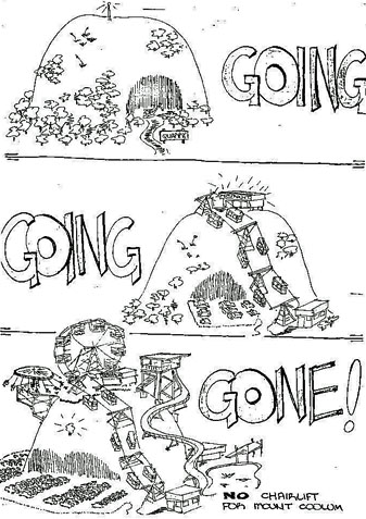
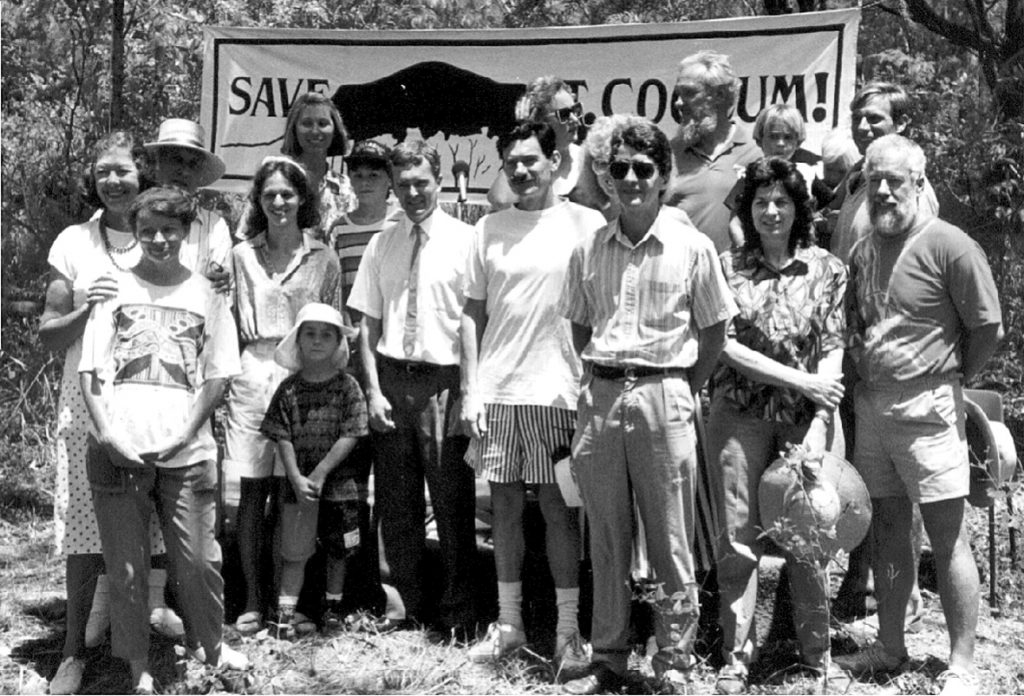
After writing about Mount Coolum in my last article, my thoughts went back thirty-five years, to January 1986. I had only lived in laid-back Coolum for a year when an earnest local lady requested that my husband and I attend “The most important meeting that [would] ever be held in Coolum”. Feeling curious, we went to the Civic Centre, along with some 450 other local people, where we heard a representative of the “Maroochy Corporation” [not linked with the Shire Council] put forward a proposal for “the development of a gondola, restaurant and flora and fauna tourist complex” on the mountain, to include “a gondola [which would] travel from the base area by cable across steel pylons to the top of the mountain where the main building would encompass facilities such as cafeteria, restaurant, function room, scenic outlooks and other tourist-related activities”. Each ‘gondola bubble’ would “allow people a comfortable all-weather ride to the top of the mountain”.
Surprisingly, the Maroochy Shire Council had passed a resolution in August 1985 that the Mount Coolum leases should be declared an Environmental Park, under the auspices of the National Parks and Wildlife Service, with the council as trustees. However, in December 1985, the same council gave approval in principle for the chairlift proposal.
The thought that Coolum’s beloved landmark could be desecrated led to the foundation of the Save Mount Coolum Committee, a small organisation which kept the anti-development lobby in the limelight with press releases, walks, bumper stickers, a powerful poster by Ron Potiphar, and even concerts. At the same time, the committee was also working on a proposal for an environmental park encompassing several Crown Reserves of varying status, but all under the control of Maroochy Shire Council.
In July 1986, the Save Mount Coolum Committee put forward a “vision” for “a place of peace and solitude … a quiet, pleasant atmosphere where families could enjoy a picnic or bar-b-que amongst the trees and perhaps the satisfaction of climbing to the top to survey the view.” The committee proposed access to the base of the mountain at two locations – the Tanah Street West site now used, and another at Quarry Road, at the southern end of South Coolum Road, where, in the lower level of the disused quarry, “bar-be-ques, toilet facilities, carpark and children’s play area … extensively landscaped with indigenous plants” could be situated.
There is a lot more to this story – and more will be covered in a later article. However, I find it interesting to compare Mount Coolum as it is today with the vision put forward in 1986, and how that vision has changed … and still there are no toilets!
What’s in a name?
22nd July 2021
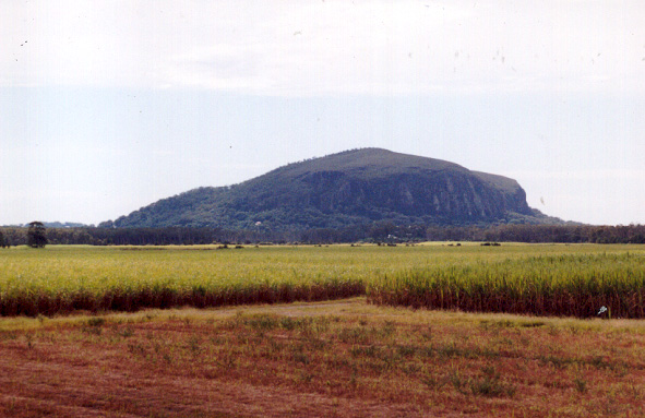
During the recent NAIDOC week, I was asked “Where does the name ‘Coolum’ come from … is it an indigenous title?” I assured the questioner that it is a Gubbi Gubbi term, but this led me to refresh my memory as to the non-indigenous history of the use of the term ‘Coolum’.
In the period when Brisbane Town was a penal settlement, from 1825 to 1852, three escapees notably lived with the Gubbi Gubbi people – John Graham [1827 – 1833], James Davis [1827 – 1842] and David Bracefell [1839 – 1842]. However, although they lived in more northern parts of the Gubbi Gubbi area, we have no records that they lived this far south, and it was not until Bracefell met with Andrew Petrie [a free settler who had travelled north in a small boat with a few others, looking at timber resources] and learned from him the names attached to some of the natural features visible from the Noosa headland. As Bracefell – who had become more proficient in the Gubbi Gubbi language than English – pointed out the natural features they could see, H. Stuart Russell, one of Petrie’s companions, wrote down the names of the places, including ‘Coollum’ [sic.], some twenty kilometres south.
Over the years, as maps were drawn, the spelling of the name varied – ‘Coolum’, ‘Coollum‘, even ‘kulum’ and ‘gulum’. One map – drawn by Thomas Ham in 1871 – was even shown as ‘Half-way Lump”!
An important twentieth-century reference – E.G.Heap’s important 1965 history “In the wake of the raftsmen: a survey of Early Settlement in the Maroochy district …” gives widely differing meanings of the term ‘kulum’, also spelt ‘gulum’. He suggests that the two spellings of the name are interchangeable, and both mean ‘wanting’ [a term which refers to the lack of peaked top on the well-rounded mountain], but that it could also mean ‘a short snake’, as in the ‘Death Adders’ often found sunning themselves there.
In 2004 we discussed the derivation of the name ‘Coolum’ with Nurdon Serico, a well-respected Gubbi Gubbi elder, who believed that the term means “wanting”. However, he explained that this did not mean “wanting [or ‘without’] a top”, but “wanting [or ‘without’] a cover”, meaning “bare of covering” … Mount Coolum is truly a bare mountain, without trees or scrub on top, and this explanation has much relevance, especially when we think of earlier, pre-European times, when Gubbi Gubbi people roamed through the heavy forests covering the low Coolum hills, and then suddenly came to the bare, rocky volcanic core, rising above them.
Like so many people, I love Mount Coolum – but I am very glad that my address is not “Halfway Lump”!
Missing that ‘Sweet smell’
8th July 2021

Several long-term residents of the Coolum and North Shore area have commented that they miss the ‘sweet smell’ which was once an annual feature from July to December due to the sugar cane harvest. The smell of burning sugar cane pervaded our lives, pleasing many, but annoying others, especially housewives who had left their washing on the clothesline overnight, only to find that the ash from burning cane had left ugly smudge marks. Children, and many adults, [not just farmers] delighted in the flames which flared high with burning trash, and the crackling noise which accompanied a burn, and in the cane trams which pulled long lines of cane trucks into the Moreton Sugar Mill in Nambour. You didn’t have to be a farmer to feel rural when you smelt burning cane in the air.
The first cane in the Coolum area was planted 140 years ago, in 1881, by Mark Blasdall, on Portion 93 – a 252 hectare selection adjoining Coolum Creek, near its junction with the Maroochy River. Mr Blasdall, wielding an axe, cleared the land of tea-trees and ploughed the land with a horse-drawn plough to remove the twisted roots. He planted nearly eight hectares of cane by hand, and cleared Coolum Creek of snags so that boats could access it, but despite all his hard work he was declared bankrupt in 1884.
In 1913, Sugar Industry magazine reported that Mr W. H. Perry-Keene, of Coolum Creek, Maroochy River district, North Coast Line had 22.4 hectares of land under sugar cane, which was expected to yield 1800 tonnes of cane. This cane was transported to Coolum Creek wharf by horse-drawn drays, and then taken to Dunethin Rock along the Maroochy River on punts lashed to a motorboat. From there it was transferred to cane trams for the journey to Nambour.
A lifting-span bridge was built across the Maroochy River at Dunethin Rock in 1921, and by 1923 the line ran to Coolum Creek, passing over two bridges linked by a mid-stream island and thence to a loading area on South Coolum Road.
Although machines were used to cut cane from the mid-fifties, cane was still cut by hand until the early 1970s, with cutters in danger of contracting Wiehl’s disease from rats living in the cane. This was the reason for burning the cane – a practice made mandatory in the 1930s, to protect workers. Burning continued after machine cutting came into practice, because it was an effective way to remove trash.
Moreton Sugar Mill, in Nambour, crushed its last cane on December 4, 2003 – although some local farms have carted cane to Maryborough since then. Now, even that avenue may close. How long will we enjoy that ‘sweet smell’?
Remembering Andrew Palser, a relatively new Coolum resident, who dedicated so much time until his recent death tracing Coolum tram lines and trying to save the cane tram bridge near River Road.
An anniversary worth celebrating
17th June 2021
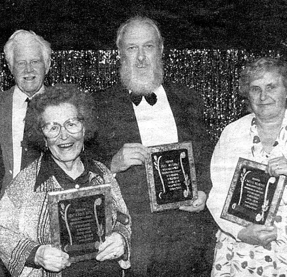
On June 30, 2021, Coolum will reach an important historical milestone. That day will mark the seventy-fifth anniversary of the day when Coolum Beach was officially declared a township, on June 30, 1946. At that time, the township of Coolum Beach, which included today’s Coolum Beach, Mount Coolum, Yaroomba, Point Arkwright, South Peregian and Peregian Springs had a population comprised of 155 men, women and children – 107 adults who were twenty-one and older, and 48 minors. There were 55 households in that area and twenty-two of the householders were farmers, nineteen were retired, six were labourers, and two were drivers, and there was one shopkeeper, one school teacher, one postmaster, one salesman, one bus proprietor and a “bait man”. Fifteen people lived on their own, there were eighteen two-person households, sixteen families of between three and five persons, and six families in households of six to ten people.
When Coolum Beach township was declared, there were 29 children attending the State School, on the corner of Warrack Street and South Coolum Road. However, over the next five years, that number varied dramatically as new families – including the Lambert and Parnell families – moved to the area, and others left. At that time, there was still only one road out of town, which was considered to be “almost impossible to keep in any reasonable state of repair”. There was only one shop, no doctor, no nurse, no electricity, no piped water … and people still had to empty their own toilet pans! At least fifteen or twenty families moved to the area, and left again within six months of a year, realising that the inexpensive land that they had bought with deferred army pay or cheap war service loans was not as idyllic as they dreamed it would be, so Coolum Beach remained a very small hamlet.
Fifty years later, the area was very different, and the 155 residents of five decades before had grown to 6999, even though the area encompassed by the name “Coolum” had become limited as “suburbs” had developed around the central core. In 1996, 1054 Coolum residents had been born overseas, and only 38 per cent of residents [2659 people] had been at the same address five years previously, At that time 1524 residents [22 per cent] were aged under 15, with most attending one of the two excellent schools.
The fiftieth anniversary of Coolum Beach was celebrated by a black-tie ball in the Coolum Civic Centre, where plaques were presented to five residents who had lived in Coolum fifty years before – Merv and Beryl Doyle, Ray Wintzloff, and John Windolf and his sister Caryll Murphy. None are left, but their legacy lives on. … Happy 75th birthday, Coolum!
Right up your street?
3rd June 2021
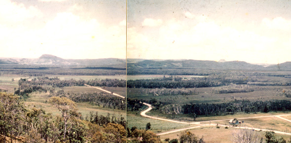
The photograph which accompanied my last article was commented on by numerous people, surprised by the amount of open space in what is now central Coolum, and this led me to seek out another photograph, taken from Toboggan Hill in 1957. This date was a watershed for the Coolum Beach area, following the arrival of electricity in December 1956, and marking the start of a rush of housing development.
The early expansion stretched westward towards the newly-situated Coolum State School, at the corner of Yandina Road and South Coolum Road, and seems to have been developed by Pinedale Developments, through Willmore and Randall – a Brisbane firm – the sole managing agents when the development was put up for sale between 1958 and 1960. The development was divided into four different areas. Morgan Park Estate encompassed the area from Elizabeth Street to Banksia Avenue, while Coolum Beach Estate included most of the sea-themed streets: Seagull, Spindrift, Sorrento, Seaspray and Sunrise Avenues, and most of the wind-themed thoroughfares: Fourwinds, Tradewinds, and Mistral Avenues, with the exception of Sea-Breeze Avenue, which was part of the Morgan Park Estate.
The Surf Rider Estate, which included names of American beaches: Long Beach, Daytona, Key West, Malibu and Santa Monica Avenues, extended to the eastern end of today’s Banksia Avenue, now a well-known thoroughfare. Banksia Avenue shared its plant-themed name with an estate towards its western end: Acacia, Pandanus, Palm and Cassia Avenues.
One street in the area, noted for its non-themed name, is Jones Parade, named after Jack Jones, a popular land salesman who worked for Willmore and Randall during the late 1950s and early 1960s. He was known for his charismatic ‘flim-flam’ manner, and his large American tail-finned car, so different from the ‘old bangers’ usually seen around Coolum at that time!
Compared to today’s concrete-edged, bitumen streets in well-designed estates, the Coolum streets were just tracks, graded across the loose sand of the wallum flats, and they deteriorated rapidly. By mid-1960, the Coolum Beach Progress Association was requesting Maroochy Shire Council to give “urgent attention” to at least seven of the new streets, and by 1962, they noted that “Coolum Beach Estate and Ocean Beach Estate roads have had no attention for the last three years … [they were] … badly pot holed, overgrown with grass, and in some cases young trees [were] establishing themselves in the roadway.” In 1963, they repeated their request, noting the “shocking state of the roads through the Ocean View Estate … [where] … In some places, particularly in Trade Winds Avenue, there are Ti-trees of considerable size growing in the drains.”
Do you live in one of these streets today? I do!
Keep calm and drink water!
20th May 2021

As water bills arrived in letterboxes last week, I heard several grumbles and complaints. This reminded me that the provision of a water supply has been the source of complaints in Coolum over many years, despite a reversal of the cause of those complaints.
In 1940, at a time when drinking water only came from the sky, every house had a rainwater tank – usually holding between 7000 and 9000 litres. For visitors who enjoyed camping near the beach however, water was a very scarce commodity, and in February 1940, the Coolum Beach Progress Association petitioned Maroochy Shire Council because, “the supply at Christmas was very poor and had it not been for private houses supplying water the Council may have been involved in heavy expenditure carting water”. Coolum Beach, at this time, had 52 residents, with another 49 people living on farms around the township.
Good news came later that year, when the Progress Association reported that, “at last we were going to get a water supply for the beach campers – a well has been put down and it was understood the water had passed the test and the Council were erecting a Wind Mill and tank and laying pipes to the Camping Area”. The water concerned came down from the slopes of Toboggan Hill, and the windmill was situated near today’s BP garage.
Unfortunately though, this was not the end of water problems for the township, and at the end of 1950, it was recorded that, “Mr Tickle drew attention to the tank in question and the need for immediate action to have tanks in position as visitors were becoming more numerous every Sunday. Besides, nothing had been done by the Shire Council in connection with the water supply generally. We do not want a repetition of last year’s performances with an inadequate water supply.”
In 1963 the Progress Association asked that the Council “discontinue the application of the [1.5 cents] Water Rate to the Ratepayers of Coolum in view of the fact that water has not been and is likely to be extended to this area in the near future.”
In 1966 Coolum residents tried to have a dam built on land owned by the Morgan family, near Jasper Court. However, the Local Government Department would not subsidise the project as it was on private property. Piping was laid for the project, but heavy rain early in 1967 filled the dam with soil, and it was abandoned. Coolum did not receive a reticulated water supply until 1972, thirty-two years after the first requests were made by the Progress Association!
Yes, I hate getting a water bill, but I’m glad that I DO get one!
No longer an “Island”
6th May, 2021
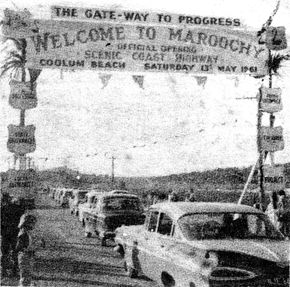
When I first met my husband, in 1985, he had a large collection of articles, photos and hand-written reminiscences about the Coolum and North Shore area, carefully labelled, and stored in cardboard apple cases. Nineteen years later – after I had taken early retirement, and we had circumnavigated Australia in our motor home – the collection had grown considerably. We decided that I should record all the wonderful stories in book form. Early Coolum had been separated from surrounding areas because there was only one road, which was sometimes flooded for weeks, even months on end, and this led to the title ‘An Island Surrounded by Land’.
On May 13, 1961 – fifty years ago – Coolum became no longer an ‘Island’ after a second road to Coolum was developed. Perhaps, then, it is time to look back on the long process, which led to road access, permitting the growth that has led to today’s bustling, sophisticated town.
In mid-1950, when the only way to get from Coolum to Noosa was to drive west to Yandina, north to Eumundi, then east to Noosa [or to drive along the beach on a tractor], Maroochy and Noosa councils agreed that at ten thousand pounds [$20,000] … “the road would be too costly to construct”. However, in May 1958 the Brisbane Telegraph announced that “North Coast local authorities are hoping private enterprise will help build the coast road to link towns from Caloundra to Tewantin”. Developers T. M. Burke acquired leases from the National Party state government which required them to build sections of road along wallum land from Sunshine Beach southwards and to establish urban areas. Testro Brothers won the leases for Marcoola [so named because it was between MARoochydore and COOLum], Willmore and Randall for the swampy beach land which became Mudjimba, and Saul Kallay for Pacific Paradise.
In 1959, access to Maroochydore from Coolum came a step closer with the construction of the Bli Bli bridge – although there was still no direct access from Bli Bli to Maroochydore – and on April 2, 1960 the through road from Peregian to Noosa and Tewantin was opened by the Queensland Premier, Frank Nicklin.
The Coolum-Peregian link was slower because Stumers Creek blocked the way with its shifting sands. However, once the necessary bridge was built, the Minister for Lands, Alan Fletcher, declared that section – decorated by flags and surmounted by an archway declaring it “THE GATEWAY TO PROGRESS” – was open, and a long line of cars celebrated by driving onto the new section.
Coolum and North Shore residents now have a wide choice of ways to travel around our area … and Coolum is no longer an ‘Island’!
Welcome home!
22nd April, 2021
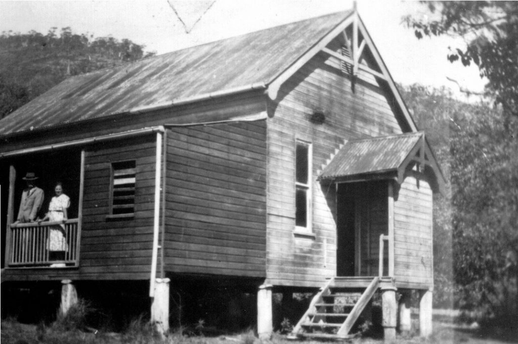
For the men of Coolum who served their country in World War 1, coming home meant returning to a very different Coolum to the one they had left. In 1915, Coolum was just a few scattered farms with fewer than seventy men, women and children residing in the area covered by the Coolum Advertiser today. There was no shop, no hall, and no school, and transport to the area was on horseback or by boat from Yandina to Coolum Creek wharf.
While the soldiers were gone, Mr. Rodgers offered his unused cottage near Coolum wharf, as a social centre to raise money to build a School of Arts hall near today’s South Coolum Road and Toolga Street corner. With its internal walls removed, the cottage hosted weekly dances, attracting patrons from other areas up and down the river. In January 1917, while the soldiers would have been under fire in France and Belgium, the new hall was built, as a meeting place and a public library, setting charges of five shillings per annum for members, who could also borrow books from the School of Arts library, from 3pm to 4pm on alternate Saturdays.
On Monday April 2, 1917, Coolum Provisional School opened in the School of Arts Hall, with eleven pupils enrolled on the first day, and another seven by the end of 1917. There had been no school available for the district’s soldiers before they left to fight, so this was a tremendous change.
Back at home, the hall could be hired for meetings for one shilling and sixpence per meeting, while use of the hall for dancing cost seven shillings and sixpence per evening use, or ten shillings if dancing continued after midnight. Musical accompaniments for dancing were simple, with local people bringing their own instruments, and ‘accordions’ – commonly known as ‘squeeze boxes’ – provided by the committee. The accordions, which cost four pounds each, were frequently damaged by over-eager patrons, so they were put in the care of the School of Arts caretaker until dancing commenced and were not permitted to be ‘used between dances’. Part of the money raised was forwarded to the Services Fund, to provide, ‘Comforts for our boys’ until the Armistice in November 1918.
After the war was over, it took some time until Australians could be brought back, due to a lack of ships. Coolum ‘boys’, Sergeant Hart and Sergeant Stumer did not return home until June 1919, and Private Wintzloff did not return until February 1920. The returned soldiers were each greeted delightedly at crowded ‘Socials’ at the hall and presented with welcome home gifts which surely puzzled them considerably … each ‘Welcome Home’ gift was … a suitcase!
A wet Easter
8th April, 2021
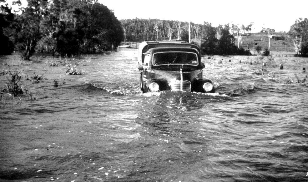
Easter in the region has been known to be wet. In 1958 the roads were severely flooded with the photo titled “Flood” taken by Ron Filer near where the solar farm stands today. Photo: Windolf collection
Coolum and North Shore residents and visitors alike looked forward to the recent Easter period as a time of relaxation and enjoyment, planning a sunny break, away from the many restrictions which have recently limited us, and many were disappointed by the inclement weather which was a feature of the long weekend. Unfortunately, the weather around the Easter period is very hard to predict, and has varied greatly over the last century or so – disappointing many, and pleasing others at different times.
In 1919, the year in which the Coolum Beach Surf Life Saving Club began, the Nambour Chronicle reported that: “On Easter Monday, the camp being augmented by many residents from the district, some 300 and odd people witnessed the official handing over of the new reel to the Coolum swimming club.” It is fair to say that 1919 was obviously a fine Easter, which allowed both residents and visitors to enjoy themselves. However, this was not always the case.
The 1950s comprised a series of very wet years, at Easter, and at other times. In 1958, the road from Yandina to Coolum [the only access to the beaches between Noosa and Maroochydore until the 1960s] was so bad at Easter time that both Brisbane newspapers reported the situation at Coolum. The Brisbane Courier Mail stated in an article headlined ‘RAIN DIDN’T STOP NORTH COAST TREK’ that “Thousands of Easter holidaymakers … risked possible flooded roads and treacherous weather to come to the North Coast yesterday.” The Brisbane Telegraph newspaper reported on how the weather had affected David Low [after whom the coastal road was later named] in an article which reported that: “Mr. D. A. Low is member for Cooroora and chairman of the Maroochy Shire Council, in which the seaside resort of Coolum is situated. On Easter Monday Mr. Low intended visiting friends at Coolum, but when they reported the state of the road to him he decided he wouldn’t take the risk with his car. Several motorists ran into trouble trying to negotiate one particular bad spot and had to be pulled out of the bog. They complain that no warning notice was posted to save them from being trapped at this spot and the danger area, which was covered with water, was not barricaded”. The photograph accompanying this article, shot by Coolum electrician, Ron Filer, was taken near where today’s solar farm is situated – that must have been a very wet Easter, for visitors and residents!
Fortunately, road access to Coolum is easier now, and there have been many ways in which visitors could enjoy their Easter break without being overly upset by the wet conditions. Maybe next year we will have a fine Easter!
A prediction from the past
25th March, 2021
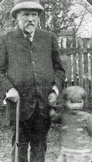
Robert Abbott and his daughter Dorothy from 1915. Photo: Contributed
Dorothy Abbott, who was born in 1912, left a legacy for today’s greater Coolum area which is worthy of our consideration more than a century later. Her father, Robert Abbott, was the surveyor for the original housing blocks in Coolum, and her grandmother, Magdalene White and her aunt, Maude Perry Keene were the two women who bought the rights to today’s central Coolum area. Dorothy grew up near today’s Jenyor Street, and was a first-day pupil at the Coolum Provisional School. Despite her family heritage of development, she appears to have been one of Coolum’s first conservationists, if we judge by this poem which she wrote in her early teens:
The Scrub Goes Down – Dorothy Abbott
Trickling stream beneath the shadows of the palms
That daunt their ferny banners to an azure sky;
Giant scrub trees hold in leafy outstretched arms
The magic of the breezes passing by
Breathing faint blessings and a sweet content,
And minding not the elkhorn’s strong embrace –
Entwining creepers – whose rich berries lent
Their fiery beauty to this elfin place
Enchanting it. And round are strewn
The falling leaves of gold and soft dull brown –
So soon – so soon
They’ll hew them down.
Out on the farthest edge, the axe
Is ringing out its message sad and grim;
I hear the moan of trees, and, glancing back,
I see a streak of light where all was dim.
We grieve together – these tall trees and I,
The little unsuspecting birds sing bravely on –
Their gay incessant chatter. Then their cry
Of terror as a giant comes down upon …
And everywhere this ruined splintered mess,
The little broken nests and dying babes;
The broken-hearted mother who, alas!
Shall have to journey far to scrubland glades.
Death or mortal friend could hardly touch
My grief today. You gave
So much … so much
I could not take a leaf and keep it green, or save …
Dear little bush-land pals forgive
For where you died – we live.
A playwright in our midst
11th March 2021
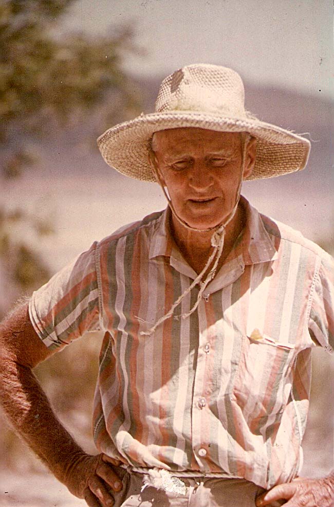
Local playwright and community champion, George Dann – photo taken in the early 1970s by Ron Filer. Photo: Windolf collection
While researching information RE: sand mining for my last article, I remembered a former Coolum resident, George Landen Dann, who was a strong activist in the fight against damaging our local beaches. I never met George, but had heard much about him.
George Dann was a quiet man, who became very well known. Born at Sandgate in 1904, he became a draughtsman in the Queensland Lands Department and Brisbane City Council, while living with – and caring for – his mother and sisters. However, he had another, more artistic side as a playwright who won many competitions, both within Australia and internationally and had many works performed on radio and TV.
In 1931, when interracial relations were considered scandalous by many, George’s play ‘In Beauty It Is Finished’ – about a love affair between a white prostitute and an indigenous man – created an outcry in the press and some churches, but was allowed to proceed with the support of public figures including the then Archbishop of Brisbane. Another of his plays – ‘Fountains Beyond’ – first performed on stage and radio in 1942, and considered his best work – told the story of an indigenous community leader from Fraser Island, who refused a “demeaning request” from the local shire chairman to stage a ‘sacred corroboree’ for a visitor. After World War Two – where George had served in an army entertainment division – Fountains Beyond was staged around Australia, and in London and Wales in 1950.
Although George continued working at Brisbane City Council, he continued his prolific writing of plays right through his working life. These won many prizes and were widely performed by amateur companies and regularly appeared on ABC radio. His subjects ranged from biblical topics to Australian history, including ‘Monday Morning’ – about a bushranger condemned on false evidence – and ‘Caroline Chisholm’ – which was said to be one of his most popular works.
In December 1954 George retired from the city council and moved to the Sunshine Coast, where he lived a few doors from today’s Clubb Coolum. Here his play-writing activities also lessened, although a 1958 radio play, ‘The Orange Grove’, set around today’s Pacific Paradise, remains popular today. He soon joined in community life, joining Coolum Beach Progress Association and becoming extremely active in the conservation battle for North Coast beaches when sand mining threatened. As he aged, he moved to Noosaville, but kept in touch with Coolum friends including Ron Filer and John Windolf, with whom he would camp on Fraser Island. He died in Eumundi in 1977, having stated, “I always humbly hoped my name would live on after I died and not die while I lived”. His name lives on!
The sands of our times
25th Feb, 2021
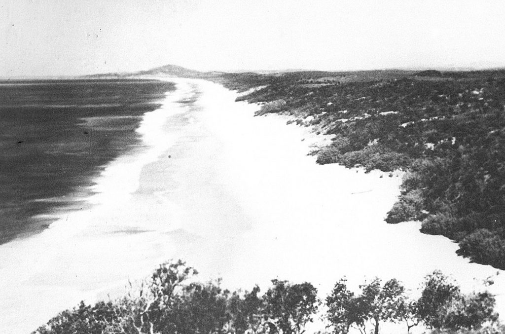
It would be fair to say that most people are attracted to our area by our beaches – the waves, or the sandy shore. Grains of sand, small as they may be, are immensely valuable to our economy, and it is interesting to consider the ways in which this value has been exhibited. We are all familiar with the attraction of our beaches and ocean to would-be residents and visitors, as exhibited in local land sales during the last century, especially in today’s residential market, but there are other aspects of our beaches which have repeatedly concerned local residents.
Currently, many of our beaches are under stress from activities ranging from proposed building activities to transport problems and sand pumping, and we are concerned for the future. However, beach stress is, unfortunately, not a new problem in our area. Since early in our residential history, the lure of minerals marking our sands with ‘peculiar black sand’ deposits – rutile, ilmenite, monazite and zircon – has attracted mineral-seekers to our area.
The first recorded venture of this type occurred in 1929, when a syndicate approached the Moreton Sugar Mill Board to transport sand from ‘a peculiar black sand deposit’ at Coolum to Nambour, for expected sales to Germany. We are told that the cartage was a “very good thing in the way of freight for the mill”, but no other records about this venture have been found, and it is possible that the onset of the 1929 Depression quashed the idea.
By the mid-1950s, however, sand mining on beaches on the eastern seaboard of Australia became a keen subject of discussion, as rutile (for titanium), zircon (for ceramics and nuclear reactor elements) and monazite (for thorium, a nuclear fuel), were dry-mined for mineral sands. In February 1956, the Coolum Beach Progress Association ‘sent an urgent telegram to the Minister for Mines objecting to mining of frontal dunes’. Indeed, they were so concerned that they also moved to ‘have a petition prepared for public signatures’ as well. Under pressure from local protestors, the Minister inspected the Coolum area, agreeing that mining companies should be required to protect trees in the area, but ‘he repeated the government view that sand mining would not disturb anybody or anything as there were few houses between Coolum and Noosa.’
Fortunately, around this time the government was changed, and historian Helen Gregory tells us that “the change of government and the plan to develop the area for tourism saved most of the beaches from the sand miners but they were permitted to move further north to Fraser Island.” Although other attempts were made until 1966, fortunately none were successful and our beaches remain safe – we hope!
The more things change …
11 Feb, 2021
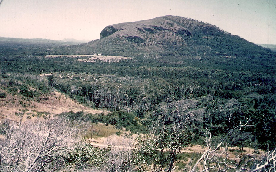
The saying, “The more things change, the more they stay the same”, seems relevant when considering one of our most discussed local facilities. In 1913 John Parker selected Portion 502, gaining permission to farm that area, while improving it, building a home, and making payments to the Government.
Portion 502 was roughly bounded by today’s Warran Road to the north, and Tanah Street to the south, stretching inland to a line roughly running between the southern end of Grandview Drive and Lagoda Drive – most of it known in recent years as the “Hyatt Regency resort”, or the “Palmer resort”. John Parker built a house where the 17th green now delights golfers, ran cattle on the land, and grew bananas, pineapples and beans for Brisbane markets. However, the area was swampy, soil quality was extremely poor, and this led to Mr Parker and a succession of other farmers, battling to make a living. From the late 1950s the land had reverted to a mixture of swamp and scrub, unsuitable for farming.
When the David Low Way opened in the early 1960s, developers realised that there might be potential in the area. The area covered by Portion 502 changed hands several times, each purchaser dreaming of a great financial future for the location. This came to fruition with the Hyatt Regency resort, described thus by the Sunshine Coast Daily in August 1988: “This $134 million resort and health spa on 150 hectares … will comprise a vast array of recreational, health, retail and accommodation facilities – eight swimming pools, 18 hole golf course, nine tennis courts and jogging track and underground tunnel to the five holes on the beach side, where the resort boasts one kilometre of beach front.”
Hyatt Regency Coolum attracted visitors from around the world. Queen Elizabeth II joined the Commonwealth Heads of Government there, at least one member of the Japanese royal family went birdwatching with my husband, film stars climbed Mt Coolum, Australian PGA championships were held there from 2002, and every-day Aussies came to stay in villas which could be owned privately or on a part-share basis. Some 700 staff were employed, making the resort the largest employer on the Sunshine Coast.
And then came the change … in 2011 the resort became the Palmer Resort, and the years since have held a litany of changes, from the Palmersaurus dinosaur park to closed facilities and on-going villa ownership troubles, settled late last year with villa owners sharing some $20 million.
”The more things change, the more they stay the same” … Will the resort flourish during Portion 502’s second century? The future could be interesting!
Moving School in 1956
28 Jan, 2021
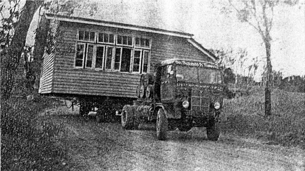
Across Coolum and the North Shore, school holidays are finishing, and a new year is beginning. Many students are looking forward to returning to their school, their friends, their teachers, and others are facing new adventures. It is safe to suggest, however, that no student will encounter the situation faced by the pupils of Coolum State School in 1956.
In the first couple of years after Mr Edward [Ted] Chapman had become Head Teacher at the school, Coolum changed considerably, with the development of subdivisions stretching from Stumers Creek to Warran Road. This meant that by the end of 1955, of the 23 children attending Coolum State School – a one room, one teacher timber building situated on the corner of South Coolum Road and Warrack Street – only one – John Windolf – lived south of the school.
A booklet produced for the school’s Golden Jubilee in 1967 explained the situation in the mid-1950s: “As more families began to settle at Coolum Beach, the two mile [3.22 kilometre] walk was proving difficult for the young children, so agitation to move the school nearer to the Beach brought action by the Education Department … District Inspector N. Pyle examined four proposed sites along the Main Road, and the parents present at the investigation gave unanimous support for the present site.”
Twenty-first century Queensland schools are large, well-designed complexes with multiple learning areas, sporting fields, libraries etc. However, in the 1950s things were much simpler. The Coolum State School building on South Coolum Road was a simple timber building measuring 6.4 by 5.5 metres in area and designed to fit 35 students. It had been built in mid-1930, and its only facilities comprised an open space under the school [used for recreation on wet days], a rainwater tank, and two “drop” toilets.
The ‘new’ school was actually not a new school at all … on January 11, 1956 the entire school was placed on the back of a semi-trailer brought from Brisbane and transported down south Coolum road to the new site beside Yandina Road, on the western edge of the extended Coolum township. When the 1956 school year started the school was in place on its new site, surrounded by dense eucalypts and tea-trees, near the burnt-out remains of an old farmhouse.
In the next few years, local residents, proud of “their” school, bulldozed trees, fought a 1957 bushfire threatening to burn the school down, built a tennis court and planted pine trees along the road edges. It was not long until a second teacher was appointed, under the original school. The original building remains – a ‘moving’ tribute to the early years of Coolum State School.
Coolum Land Sale in 1922
Jan 14, 2021
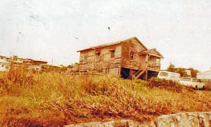
The house owned by the Jocumsen family as it looked in 1922. Photo: Windolf collection
In my last article I promised details from Coolum’s first land sale, on Boxing Day 1922 … little did I know that on the very day I sat down to write this article, a visitor would arrive with details of their family’s purchase on that day, bringing the story to life!
The Nambour Chronicle from December 29, 1922, which suggested that the sale day might “be looked back to as the birthday of what must in time become a very fine seaside town” reported that, “People flocked there from every possible direction” by road, by boat and by cane tram – “easily 1000 all told”. Although many people just came for the occasion, 47 allotments were sold, at an average price of 52 pounds [$4316 in today’s terms] for a block that was 16 perches [roughly 531 square metres] of beachfront land. The most expensive block sold for 79 pounds [$6557 today] – of course, this was undeveloped land with no water, electricity or sewage services and dirt roads prevailed making for a long journey from buyers’ homes!
Last year, a Mr Jocumsen visited us, seeking to establish the location of his grandfather’s Coolum home. Initially, we were only able to locate a few early photographs of that area of the Esplanade, and we could not trace the house which Mr Jocumsen recalled seeing as a child. It has now been established, through the Department of Resources, Mines and Energy, that his grandfather – Andrew Jocumsen, a Yandina sawmiller – bought one of those original blocks [Lot 152, which was 21 perches in area] at the Boxing Day sale in 1922, on land previously owned, before the 1922 sale, by Piercey Maud Perry-Keene and her mother, Magdalene White. Andrew Jocumsen died young, in 1934, leaving his holiday house to his wife.
One early photograph located stirred Mr Jocumsen, but it was labelled “Jorgensen’s house … built by Mr Best C. 1930”, so the search continued, seemingly without success. It now appears – through the paper trail provided by the Department of Resources – that this photo showed the correct house, but Mr Jorgensen was its eighth owner. The building known as “The Rocks” is now on that block of land.
Why have I shared this story – with the permission of the original owner’s grandson? I know that many current – and past – Coolum residents and visitors have sought distantly remembered or historically related homes of their ancestors, and many of them have contacted my late husband and me for help. I am always happy to assist, where possible, but there are other avenues as well. Online newspapers, your local library, and Government departments are places where you might find treasure!
Coolum’s most important day?
24th Dec, 2020

Muriel Broe [later Dr Pawlick], Hilda Tait and Gladys Low slide down ‘Toboggan Hill’ in 1922. Photo: Windolf collection
Most Coolum people would be guilty – at some time – of commenting “Coolum’s not like it used to be”, particularly when considering the current housing situation. Perhaps the most important day in the historical development of Coolum housing occurred on Boxing Day 1922, 98 years ago, changing the area from isolated farming hamlet to holiday destination, and a home for many.
Newspapers far and wide trumpeted the glories of “Mt. Coolum Beach” … not the Mount Coolum area we know today, but 100 or so allotments, “all with an uninterrupted view of the Pacific Ocean”, running south along The Esplanade to Point Perry, and inland as far as Coolum Terrace. The advertisement declared that the area possessed ”attractions far beyond any other seaside in South Queensland” with a, “superb and absolutely safe beach for Surfing”. Other attractions included sporting activities such as fishing; seasonal shooting of ducks, quail and snipe; and a hard and level Beach Racecourse, “where later on all the motor speedsters will score in a straight 5 to 10 miles run at 80 to 100 m.p.h.”
The hill just to the south of Beach Road [still known to some locals as “Toboggan Hill’] was described as ”the thrilling natural toboggan … to be reserved for the Residents’ and other attractions included “ mountaineering on Mount Coolum, where the view from the summit is entrancing” and “Scrub Hunting for orchids and ferns in the gorge and in the dense tropical scrubs.”
Other delights promised “Ladies and Gent’s bathing sheds and lavatories, Maypole and Swings already erected and handed over to the local Shire Council” and “Golf Links already laid out, and now playable” [although no-one ever seems to have sighted these wonders!] as well as “Cricket, Football and Tennis facilities etc. etc”.
An article in the Nambour Chronicle told prospective buyers that “The new road from Yandina has been completed and is now accessible by motor car from Nambour [70 minutes] or from Yandina [40 minutes], and, in addition … arrangements have been made with the Moreton Sugar Mill for the early use of their tramway now under construction, which will allow the journey to be made easily within 30 minutes from Nambour”. The article continued, “Anticipating a large number of visitors and campers … the Maroochy Co-Op Store has opened a branch upon the Estate.” This was the first shop in Coolum.
Most campers hired tents on site, and today’s residents will be happy to know that they were advised that, “there will be no necessity to bring mosquito nets as sandflies and mosquitoes are unknown on the estate”
My next article will provide details of this all-important sale, including prices of the allotments!
Christmas Party Time – 1943 style
10th Dec, 2020
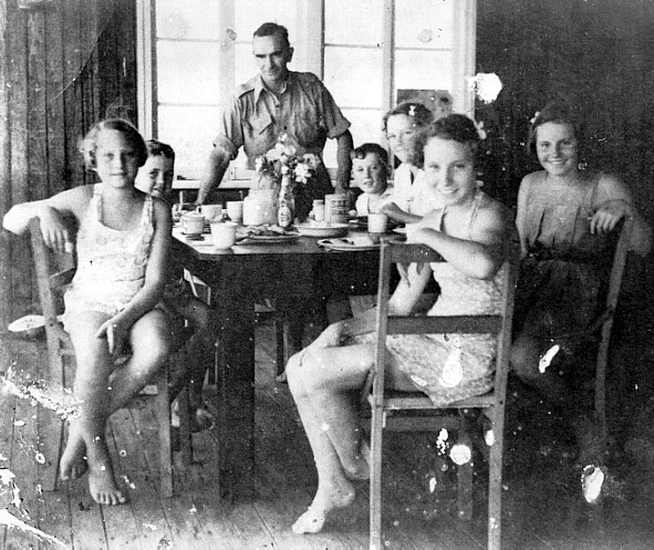
Christmas 77 years ago in Coolum during World War 2. Photo: Windolf collection
Even though the Covid-19 Pandemic has affected traditional partying for children in 2020, our young ones are still enjoying a plethora of seasonal Christmas activities. However, local Coolum kids experienced a very different run-up to Christmas in 1943, during World War 2.
On one hand, a number of local children had left the Coolum district, heading inland with their mothers to areas considered less dangerous than the coast – where Japanese vessels might perhaps come ashore in this area, above the “Brisbane Line” of security. Others had relocated with their mothers to more-distant relatives who could help with childcare. The School Register for Coolum State School shows that there were 19 children at the school in 1943. In 1942, trenches had been dug there, and the children drilled daily in their use, putting wooden pegs between their teeth so that they wouldn’t bite their tongues if a bomb fell.
There were few younger men in the Coolum district at this time, as many had joined up – twenty-one Coolum men served in the Armed Forces, as well as seven Coolum women. Early in 1943 the Hospital Ship Centaur had been blown up and sunk near Bribie Island, and this impacted Coolum people. Some saw the blast from surrounding hilltops, and others – advised by the Army – searched the beaches south of Point Arkwright for wreckage, finding not just parts of the vessel, but items such as board games and a card table. These items were delivered to the Corner Shop in Coolum for inspection.
Older Coolum men, such as Jack Morgan senior, Fred Stumer, Percy Hewitt and Victor Marsh, helped form a unit of the Volunteer Defence Corps, still remembered by a sign on Point Perry. The VDC unit was lucky, in that part-time Coolum residents [and full-time artists] loaned their holiday house on Scrub Road to the unit for the duration of the war, as a “lookout station”, as they were unable to travel to Coolum because of their active voluntary war work in Brisbane – especially because of limited availability of petrol vouchers.
Coolum children were invited to a wartime Christmas party at that house in December 1943, with the VDC unit attempting to brighten the lives of those who were undoubtedly living in quite straightened circumstances, and a photograph taken that day shows their happiness. We know that there were no cold drinks or ice creams because Coolum had no electricity. Butter and cream and eggs were limited, as was sugar, so it was possibly sandwiches, and un-iced cakes made with margarine. There is no record of Santa visiting, and no decorations, but the old photo shows the spirit of a simpler – joyful – time, 77 years ago!
It’s School Break-Up Time!
3rd Dec, 2020
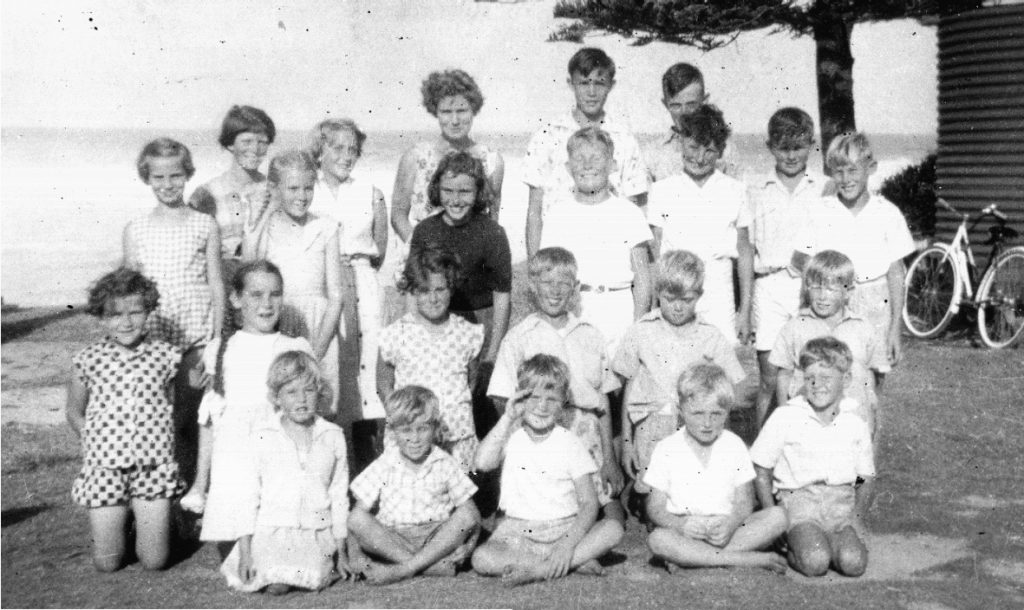
Although 2020 has been a very mixed-up year for Coolum and North Shore students and their parents, school break-up is an important feature in November and December. Consequently, I thought it worth reminiscing on Coolum school break-ups in past times.
In 1917, the first year of Coolum Provisional School – in the School of Arts near the corner of today’s South Coolum Road and Toolga Street – a break-up picnic was held on Thursday December 13th, not only for the eighteen students, but as a general holiday for all Coolum residents. The students and their parents gathered around noon for lunch, after which – we are told – “races, tug-of-war, jumping, etc., were indulged in by the children for prizes donated by parents and residents generally”. The fun included three adult tug-of-war competitions, with married men competing against single men and winning two out of three events.
At 3pm an impromptu concert was held in the school, with Mrs Perry-Keene playing her portable organ, and Mrs Morgan, Mrs Wintzloff, Miss Cook, Mr Cameron and Mr Short singing songs. After that, Mr Short presented one book to each child and extra book prizes to six of them, as well as a handbag to the teacher, Miss Chapman. After singing ‘God save the King’, everyone shared a meal, and at 8pm dancing, interspersed with more songs, commenced – and the celebrations continued until 11.30 pm!
In December 1955 Coolum State School, on the corner of South Coolum Road and Warrack Street, had a total of 23 students, from Years 1 to 9. Their break-up celebration was held at the shelter-shed which stood opposite today’s Coolum Caprice, and every child attended, as well as several parents … some parents were still involved in harvesting their cane and small crops.
Once everyone had arrived, the most senior boy and girl were sent across to Bob Tickle’s hut to invite him to join the adults sitting on the benches around the shelter shed – he would never attend without this invitation. The mothers then passed food around – egg or meat with pickle sandwiches, iced patty cakes, cream sponges, jam drops and lamingtons, washed down with bottles of Wimmers lemonade and creaming soda. Then games – egg and spoon races, three-legged races, and sack races – filled the time until lunch, and the rare treat of tubs of Peter’s ice cream, brought from Nambour in a green canvas container holding ‘dry ice’.
Every child received a book, presented by the school principal, Ted Chapman, and after that, students played on the beach until home time. This day was particularly poignant, as it was the last day for that school … 1956 was to see yet another start in Coolum education.